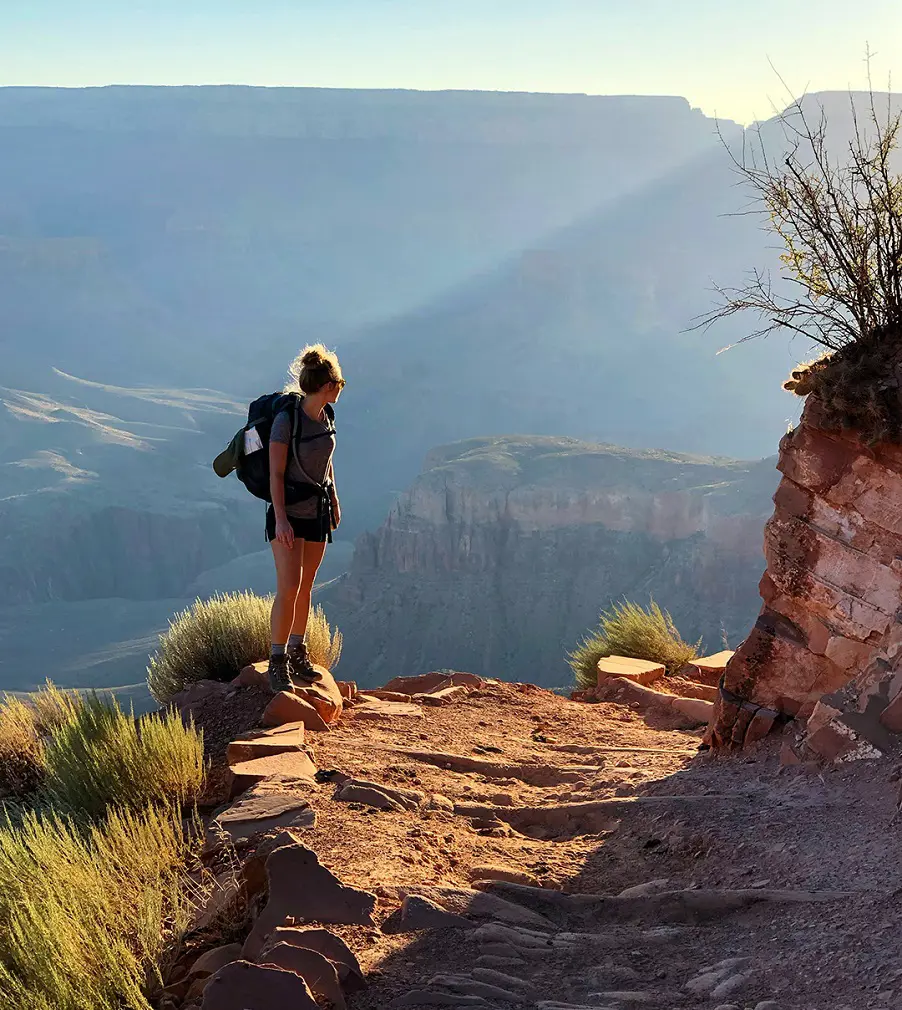
Phoenix, Arizona, is commonly known for its extremely hot and arid desert, but it's not just limited to sun and sand. The Valley of the Sun boasts breathtaking sunsets, mountain vistas, desert flowers, and diverse outdoor adventures.
The city is surrounded by multiple mountain parks, including South Mountain, the largest municipal park in the US, and giant National Forest lands, offering endless possibilities to explore. Here are 20 of the best trails and hikes in Phoenix that highlight the stunning landscapes and unique natural beauty this city has in store for people.
1. Bobby’s Rock Trail
- Distance: 1.8 km
- Elevation Gain: 49 m
- Difficulty Level: Moderate
The Bobby's Rock Hiking trails in Phoenix is a 1.8-km loop trail with moderate difficulty level and it takes just half an hour to finish the route. Refer to your map as Bobby's Rock Trail is not always clearly indicated. Visitors will be treated to breathtaking vistas of the park and downtown as they travel.
There are loose and rocky sections of the path, therefore hiking shoes with strong grip are advised. There are numerous granite stairs on the trail that allow you to ascend and increase your heart rate.
2. Shaw Butte Loop

- Distance: 7.2 km
- Elevation Gain: 284 m
- Difficulty Level: Moderate
The 7.2-kilometer Shaw Butte Loop trail is located close to Phoenix, Arizona, and it takes 2 hours and 16 minutes to finish on average. As this is a well-liked location for running, hiking, and birdwatching, you may probably meet other visitors while exploring.
The route is lovely to explore at any time of year and is open year-round. Dogs are welcome, but they must be kept on a leash also please be advised that dogs are not permitted on this route or any other in the city of Phoenix when the temperature rises beyond 100 degrees Fahrenheit.
3. Mormon Loop and National Trail
- Distance: 8.2 km
- Elevation Gain: 358 m
- Difficult Level: Moderate
This trail links the Mormon and National trails to form a scenic lollipop loop through part of a stunning desert landscape. The Mormon Trail has some great panoramic views of the valley and features a variety of flora, making for an aesthetically interesting start, and is among the best hikes in Phoenix.
Where the path joins the National Trail, the scenery becomes more rugged and rockier-a bit more challenging for the hiker. Although rather difficult, this part of the journey opens up to a wide panoramic view, making this day's effort rewarding for those seeking beauty and adventure.
4. Piestewa Peak Summit Trail
- Distance: 3.7 km
- Elevation Gain: 351 m
- Difficulty Level: Hard
Piestewa Peak Summit Trail is one of the popular destinations due to its proximity to the Phoenix metropolitan area and the views it offers of the Sonoran Desert. It is a short, highly rewarding climb, with expectant amazing views that include Camelback Mountain, Dreamy Draw Recreation Area, and the city of Phoenix.
Starting from the parking lot on Piestewa Peak Drive, this route quickly connects to a connector trail that takes you directly to the summit. Great if you want a great workout, especially if done at the right time for a sunset hike.
5. Fat Man's Pass via Mormon Trail
- Distance: 6 km
- Elevation Gain: 283 m
- Difficulty Level: Moderate
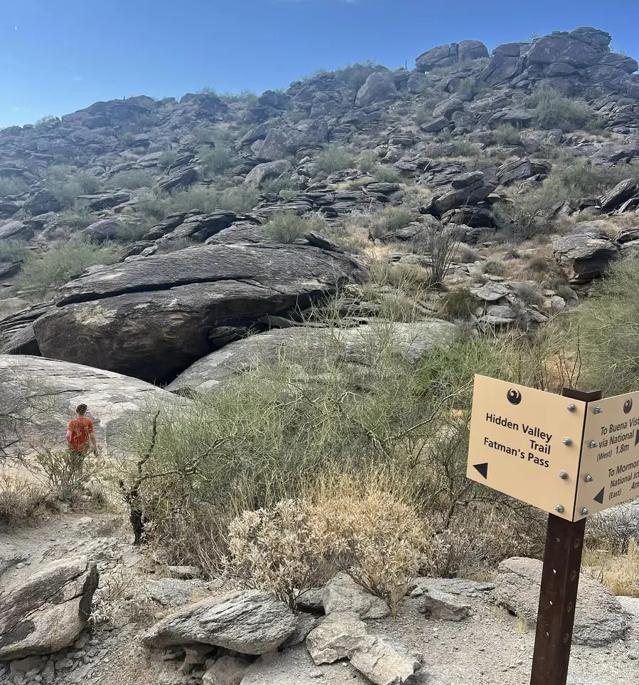
Fat Man's Pass on the Mormon Trail is a picturesque hike with springs, man-made tunnels, dry waterfalls, and the tight squeeze of Fat Man's Pass. The first mile is pretty grueling, but the top of the ridge offers great views for a reward. When on the ridge, hikers are introduced to more fun and exploration in the Hidden Valley Loop.
As this trail is so close to Phoenix, it is popular, particularly on weekends in the winter. Early visits or those during the week are best to avoid the crowds. This trail also attracts mountain bikers and horseback riders.
6. Acer Summit via Mormon Trail
- Distance: 3.9 km
- Elevation Gain: 227 m
- Difficulty Level: Moderate
The Mormon Trail takes the adventurer onto Acer Summit, which is named for its sharp and strong characteristics. The trail offers an arduous yet enjoyable incline that makes reaching the highest accessible point rewarding.
The trail itself is rocky, adding to its very rugged appeal. When summited, the view is outstanding. Hikers should still watch for rattlesnakes, which are common in this area during the summer months. This is an excellent trail for those desiring a rewarding hike.
7. Holbert Trail to Dobbins Lookout
- Distance: 6.8 km
- Elevation Gain: 304m
- Difficulty Level: Moderate
The Holbert Trail starts with steep inclines that will get your heart racing, but the challenging climb is well worth the effort. As you reach the summit, you'll be rewarded with stunning views of the city and the television tower atop the mountain.
To begin the hike, head to South Mountain’s main entrance and turn left past the visitor center. Follow the road to its end to find the Holbert Trailhead. Once at the top, a right turn will take you to Dobbins Lookout for even more spectacular views.
8. Javelina Canyon and Ridgeline Loop Trail
- Distance: 5.6 km
- Elevation Gain: 179m
- Difficulty Level: Moderate
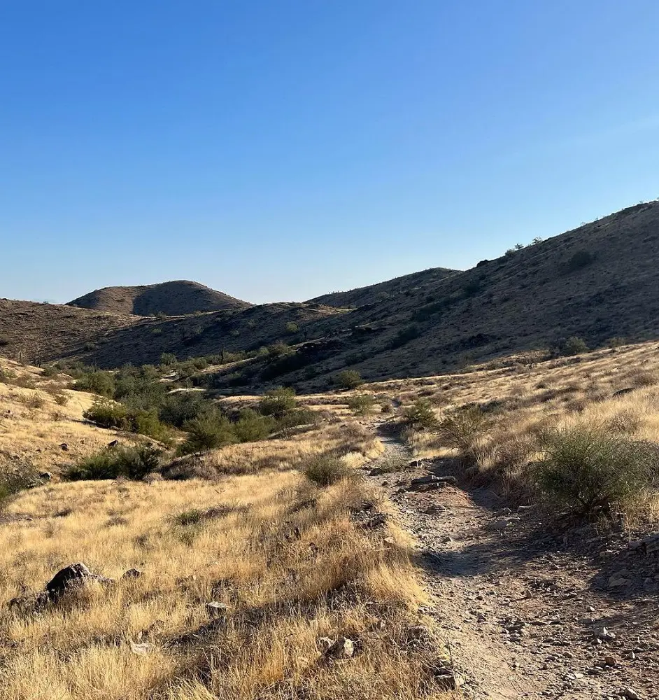
The route from Beverly Canyon Trailhead takes a scenic tour across the Javelina Canyon Trail, which follows a seasonal stream that is perfect for a serene environment. Arriving at the junction, it turns on the Ridgeline Trail to head back toward the trailhead.
It's a multi-use trail used equally by hikers and mountain bikers, taking in a faraway picturesque view of the surrounding mountains and south Phoenix. The varied terrain of this combination with stunning landscapes makes it quite popular among all who look to enjoy the fresh outdoors.
9. National Trail to Mormon Loop
- Distance: 10km
- Elevation Gain: 255m
- Difficulty Level: Moderate
The National Trail to Mormon Loop trail is a very scenic desert hike with great views and interesting rock formations for the outdoors. It's an easy-to-follow trail because there are just two major routes: the National Trail and the Mormon Loop; each has great desert landscape views.
This is a multi-use trail and is shared by both hikers and mountain bikers. Be prepared for varied trail users. There are several trail splits along the route, so it's advisable to consult the map to make sure you're on the right path before continuing.
10. Freedom Trail
- Distance: 6.4 km
- Elevation Gain: 335m
- Difficulty Level: Hard
For an adventurous hikes near Phoenix, this trail is a fantastic choice, especially in the spring when wildflowers bloom beautifully along the path. The moderately challenging route is well-marked and features rugged, uneven terrain with numerous ups and downs, making it a great workout for hikers.
The trail's loop offers cityscape views from its backside, though it can be a bit noisy. Along the ridgeline, you'll encounter several stunning vistas, and there's an option to take a spur trail to the summit for even more breathtaking views. While dogs are allowed in the area, they are not permitted on the Piestewa Summit Trail section.
11. Bursera Loop Trail

- Distance: 5.6 km
- Elevation Gain: 229 m
- Difficulty Level: Moderate
The Bursera Loop Trail is a 5.6-km loop trail hike near Phoenix, Arizona is usually seen as a somewhat difficult route. Since this is a well-liked location for running, mountain biking, and hiking, you'll probably meet other visitors while exploring. October through May are the ideal months to explore this trail.
Dogs are permitted on this trail, but they must be leashed. The Bursera Loop path makes use of a recently constructed path (2020) to complete a loop with the Bursera Trail. The closest trailhead is located close to 19th Avenue on Chandler Blvd.
At the foot of the ridge, the new segment of the trail travels east to west. The western portion of the loop features a strenuous ascent up Bursera Canyon.
12. Apache Wash Sidewinder Loop Trail
- Distance: 4.0 km
- Elevation Gain: 80 m
- Difficulty Level: Moderate
This Apache wash sidewinder loop trail normally takes around 1 hour to complete. As this is a highly sought-after location for mountain biking, horseback riding, and birdwatching, you may probably run into other visitors while exploring. The route is lovely to explore at any time of year and is open year-round.
Dogs are allowed, but they need to wear leashes. This is a wonderful short walk that winds through the Sonoran Desert Preserve of Phoenix. The trail is a photographer's dream because of its breathtaking views of the mountains, saguaro, and wildflowers.
13. Dreamy Draw Short Loop
- Distance: 3.2 km
- Elevation Gain: 91 m
- Difficulty Level: Moderate
The 3.2-kilometer Dreamy Draw Short Loop path is located close to Phoenix, Arizona, and it takes 53 minutes on average to finish. As hiking, horseback riding, and bird watching are the main draws in this area, you'll probably run into other visitors while exploring.
The route is lovely to explore at any time of year and is open year-round. Dogs are allowed, but they need to wear leashes. It is advised that users use the offline map when hiking this trail. It has been noted by users that the trail is poorly marked.
14. Marcos de Niza Trail
- Distance: 3.1 km
- Elevation Gain: 133 m
- Difficulty Level: Moderate
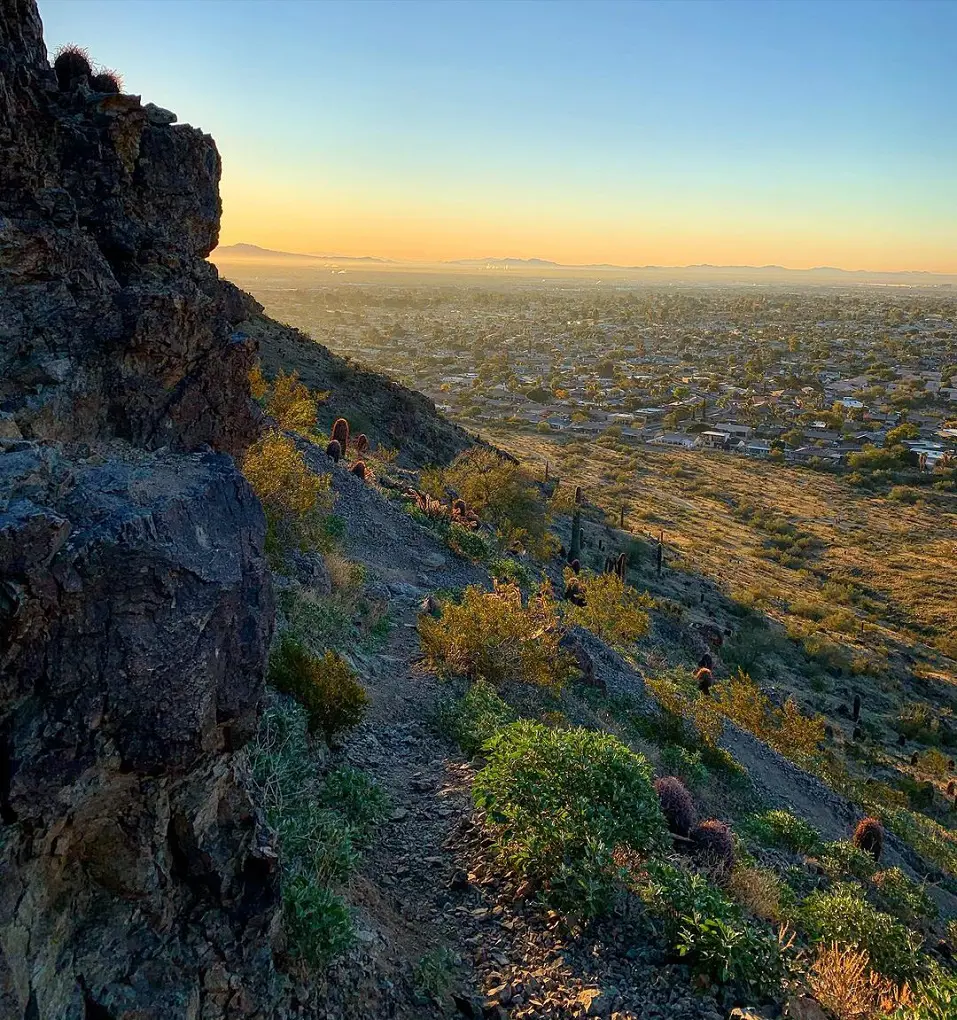
The French explorer Marco de Niza, who entered New Mexico in 1539 by passing via Arizona, is honored by the name of this trail. There are steep grades and switchbacks at the start of the trail. The well-marked path begins at the southernmost point of the Pima Canyon parking area.
A 16th-century etching claimed to be by Marco De Niza can be found along the trail; however, it was subsequently shown to be a faux, created in the 20th century. Nearly the whole length of the trail, on a clear day, provides breathtaking views of the valley. The trail has steep inclines, narrow trail widths, and extremely jagged rocks.
15. Desert Tortoise Trail
- Distance: 4.5 km
- Elevation Gain: 110 m
- Difficulty Level: Moderate
There are many different levels of difficulty here, making it an excellent place to hike. After a brief ascent from the parking area, there are some gradual elevation changes along the trail.
Although there is a slight incline on the back side of the loop, it meets Dixie Loop on the return with another rise. Because Cholla cactus grows near the route, bear that in mind if you intend to bring your pet with you as they allow you to bring dogs but should be on a leash.
16. Pima East Loop
- Distance: 3.7 km
- Elevation Gain: 87 m
- Difficulty Level: Easy
This is a short, easy route with flat and hilly terrain that provides fantastic views of the city and surrounding mountains. Trail running can be difficult on this route because of its occasional rocky sections. There may be Gambel's Quail and coyotes in the vicinity.
Although there is occasional city noise along the road, the trail is generally peaceful. October through May are the ideal months to explore this trail. Dogs are allowed, but they need to wear leashes. The entire route would take about an hour to complete.
17. Two Bit Peak Trail

- Distance: 4.2 km
- Elevation Gain: 268 m
- Difficulty Level: Moderate
The Two Bit Peak Trail, or Dixie Peak, is one of the more strenuous hikes within the Phoenix Mountain Preserve area. Expect steep inclines, loose rocks, and some scrambling sections; hence, sturdy footwear and hiking poles are necessary.
There is no shade on the trail, so one should be prepared for a hot and exposed climb up, but rest assured that the 360-degree panorama from its summit is well worth the effort.
Time your hike to catch the sunrise or sunset from the peak for an extra special experience. It's a challenging trail, but the breathtaking vistas at dawn or dusk make it all the more rewarding.
18. Piestewa Nature Trail 304 Loop
- Distance: 2.1 km
- Elevation Gain: 82 m
- Difficulty Level: Moderate
With its stunning vistas of Piestewa Peak and the far-off metropolis of Phoenix, this amazing trail welcomes you to explore a portion of the Phoenix Mountain Preserve. Be on the lookout for lizards and chipmunks as you make your way along the rugged landscape.
Cacti spikes should be avoided, especially if you're walking your dog. Close to the parking area are water stations and immaculate restrooms. Additionally, it takes 40 minutes on average to finish.
19. Ridgeback Overlook
- Distance: 4.0 km
- Elevation Gain: 102 m
- Difficulty Level: Moderate
Along with a steep ascent to Ridgeback Overlook, this scenic trail winds across breathtaking desert scenery and provides excellent exercise. After taking in the expansive views of the entire valley from the summit, return the same way you came. It also takes an average of one hour and four minutes to finish.
Horseback riders, cyclists, and walkers all share the well-kept trail. Along the journey, you might see coyotes, snakes, lizards, and gophers, among other creatures. There are loose pebbles in the landscape, so it's a good idea to wear shoes with strong traction.
20. Dixie Mountain Loop Trail
- Distance: 8.2 km
- Elevation Gain: 295 m
- Difficulty Level: Moderate
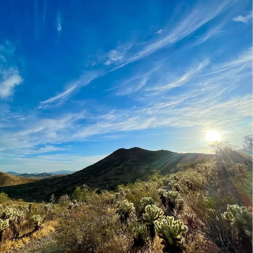
The main loop trail at Sonoran Preserve in Phoenix has flexibility for short walks and longer hikes featuring small ups and downs of gentle elevation change. Unique sights along the trail include the Teddy Bear Cholla forest between milepost 2.6 and 2.75, with a unique desert landscape.
It lies in a transition zone to the Arizona Upland, meaning the Sonoran Preserve gets more rainfall than the other hikes in Phoenix area. This, in turn, adds to the diversity and lushness in the life of plants, thereby making this area vibrant for nature enthusiasts.


