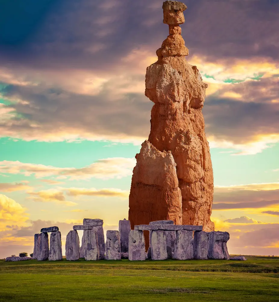
Hiking in Bryce Canyon National Park is among the most beautiful in the country; it is renowned for its gorgeous hoodoos and lively red rock formations. This well-known park, tucked away in southern Utah, is an outdoor lover's paradise.
Every road shows different landscapes and expansive views, from the renowned Navajo Loop Trail with its dramatic drop via tiny rock walls to the less-traveled Fairyland Loop. Here we have listed 20 hiking trails in Bryce Canyon National Park.
1. Navajo Loop and Queens Garden Trail
- Distance: 4.8 km
- Elevation Gain: 199 m
- Estimated Time: 1h 33m
- Difficulty Level: Moderate
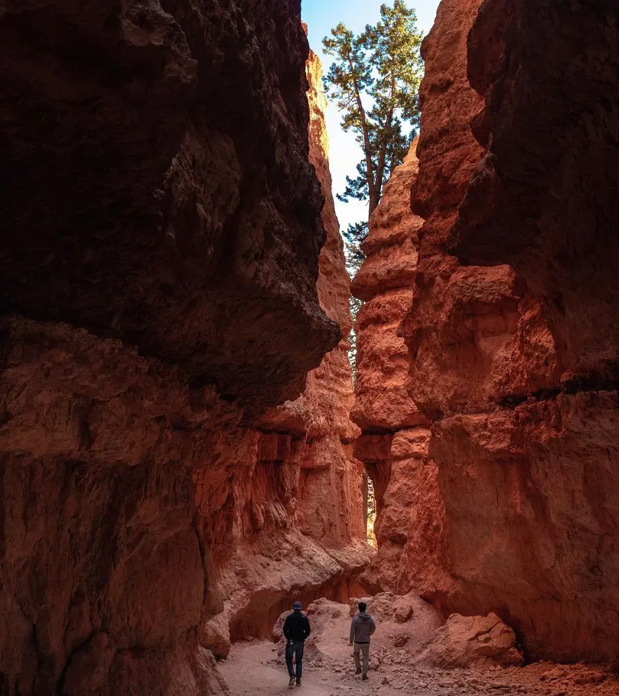
Bryce Canyon National Park's Navajo Loop and Queens Garden Trail provide visitors with an up-close look at the park's well-known spires and hoodoos. Hiking around the Navajo Loop begins at Sunset Point and takes you via Wall Street, a small canyon where you can see landmarks like Two Bridges and Thor's Hammer.
The path goes on to Queens Garden, where you'll find yourself encircled by magnificent rock formations, such as Queen Victoria. The frost-wedging process molded the hoodoos, demonstrating the force of erosion.
After finishing at Sunrise Point, you'll return your steps along the Rim Trail while taking in expansive vistas of the vibrant canyon. This hike is a truly memorable opportunity to find out the distinctive geology of Bryce Canyon.
2. Fairyland Loop Trail
- Distance: 12.7 km
- Elevation Gain: 474 m
- Estimated Time: 3h 54m
- Difficulty Level: Moderate
The 12.7-kilometer Fairyland Loop Trail begins at Fairyland Point in Bryce Canyon National Park and winds through beautiful hoodoos and stunning canyon views. The hike is moderate to difficult, with multiple elevation changes and a section that runs from Sunrise Point to Fairyland Point along the Rim hike.
It takes around four hours to do the loop, and hikers should bring at least one quart of water for every two to three hours of hiking. There is an extension on the route that leads to the magnificent Tower Bridge formation.
To protect yourself from the sun during the summer, you must either wear a wide-brimmed hat or use sunscreen.
3. Wall Street and Queens Garden Loop Trail
- Distance: 5.1 km
- Elevation Gain: 196 m
- Estimated Time: 1h 35m
- Difficulty Level: Moderate
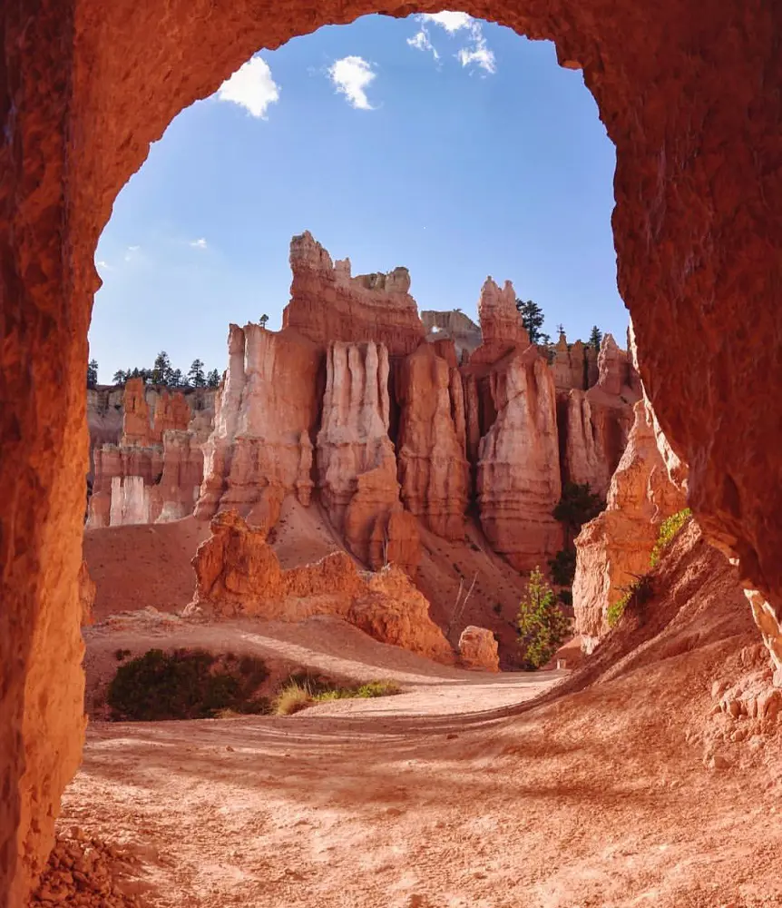
Winding past famous red rock formations in Bryce Canyon, the Wall Street and Queens Garden Loop Trail is a common and busy loop that provides amazing vistas. A tiny stretch of the trail called Wall Street is particularly well-liked in the summer but is frequently blocked in the winter because of icy conditions.
Hikers can adjust their route by skipping the Navajo Loop portion, which is still a breathtaking experience when Wall Street is closed. Hikers should not miss this trail because it provides a special chance to find the geological marvels and scenic splendor of the canyon.
4. Navajo Loop Trail
- Distance: 2.4 km
- Elevation Gain: 157 m
- Estimated Time: 58m
- Difficulty Level: Moderate
Hikers ought to visit the Navajo Loop Trail in Bryce Canyon National Park. This 1.5-mile walk begins at Sunset Point and descends 550 feet into the amphitheater. It passes through "Wall Street," a spectacular slot canyon surrounded by Douglas fir trees and high cliffs.
Famous sites like Thor's Hammer, a remarkable rock formation that resembles a hammerhead, and breathtaking vistas of the "Silent City," where rock formations imitate historic towers and temples, may be seen along the route. Views of the "Temple of Osiris" in the east are also visible from the route.
The majority of hikers finish the loop in one to two hours, however, for a more ambitious experience, they can link to the previously mentioned Queen's Garden Loop or the Peekaboo Loop.
5. Peekaboo Loop Trail
- Distance: 8.4 km
- Elevation Gain: 466 m
- Estimated Time: 3h 7m
- Difficulty Level: Moderate
Bryce Point is the starting point of the thrilling Peek-A-Boo Loop Trail at Bryce Canyon, which drops rapidly to the canyon bottom. The track, which is well-known for its turns and elevation variations, astonishes hikers with breathtaking views around every corner.
Despite being rated as moderate by some, the hike is difficult due to its length and steep elevation. Horses share this trail, so use caution when approaching them. One of the most well-liked routes in Bryce Canyon, it offers breathtaking rim-top views of the hoodoos.
Hikers can prolong their journey by connecting to the Navajo Loop or Queen's Garden paths at the northern junction. This makes for an unforgettable experience.
6. Sunset Point and Sunrise Point via Rim Trail
- Distance: 1.9 km
- Elevation Gain: 26 m
- Estimated Time: 26m
- Difficulty Level: Easy
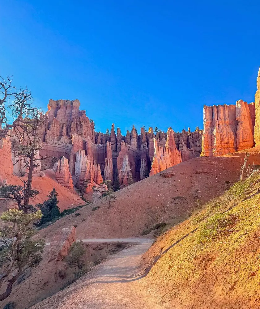
There are numerous routes to Sunset and Sunrise Point, two popular vistas in Bryce Canyon. This route gives you a tour of the canyon rim as well as viewpoints. Starting at Sunset Point parking, you'll take a tour of an amphitheater filled with hoodoos before arriving at Sunrise Point.
And you'll come back the same way. There are very few dog-friendly routes in all of Bryce Canyon National Park, including this portion of the Rim Trail.
It is likely possible for visitors to use strollers, wheelchairs, or other mobility aids on this trail. The paved parking lot has five designated van-accessible parking spaces with striped access channels.
7. Mossy Cave Turret Arch and Little Windows Trail
- Distance: 1.4 km
- Elevation Gain: 37 m
- Estimated Time: 0h 23m
- Difficulty Level: Easy
A leisurely walk beside a creek in Bryce leads you past hoodoos, to a waterfall, and into a mossy cave with hanging icicles in the shaded areas. If you're tight on time and would prefer a shorter trip, Mossy Cave is an excellent choice.
You may enjoy the entire canyon experience from this ideal short walk without having to hike down into the canyon. Additionally, the walk offers views of a protected overhang known as Mossy Cave in one direction and access to Water Canyon in another. In the summer, mosses cover this space, and in the winter, icicles form here.
8. Queen Victoria via Queen's Garden Trail
- Distance: 3.4 km
- Elevation Gain: 140 m
- Estimated Time: 1h 5m
- Difficulty Level: Moderate
Queen's Garden path, one of the most appreciated trails in the park, winds down and curves along a ridgeline for around a mile until it reaches a distinctive hoodoo that is supposed to resemble Queen Victoria. To see this hoodoo, make sure to take the spur path at the trail's base.
The numerous statues and other decorations seen within the Queen's "Garden" are said to surround this hoodoo, which is surrounded by a variety of colorful rock formations.
The Queen's Garden Trail is the least difficult of the six paths that lead down into the Bryce Amphitheater, however, it is still rated as a moderately difficult hike because of the park's high elevation and some steep gradients. Also, the trail offers views of a bristlecone pine grove close to the Horse Trail intersection.
9. Tower Bridge Trail
- Distance: 5.5 km
- Elevation Gain: 252 m
- Estimated Time: 1h 51m
- Difficulty Level: Moderate
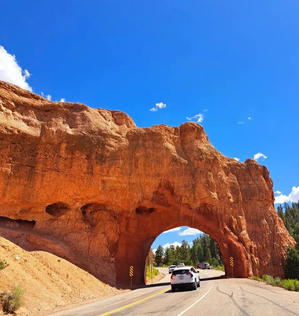
Excellent hike with lots of different scenery. The climb to Tower Bridge and back was a nice way to end the day, but you could always extend it as it is a part of the Fairyland Loop for a longer hike. There are some quite lovely hoodoo views.
At the end of winter, the trail gets a little wet and snowy, but it's also pretty wide even with a few pebbles. Although this trail is not nearly as well-known as the Queens or Navajo trails, it is still worthwhile to explore for some variety.
10. Bryce Point to Sunset Point Trail
- Distance: 8.7 km
- Elevation Gain: 221 m
- Estimated Time: 2h 18m
- Difficulty Level: Moderate
Hikers in the area advise beginning this trek early enough to return well before dusk. You won't be able to catch one of the final shuttles to Bryce Point and stroll down to Sunset Point if you arrive a while later.
Late at night is usually not too busy for these. After that, you can get some food to eat and then head to the lodge or visitor center to see a night sky program. As an alternative, you might decide to complete this early in the morning and utilize it as a morning run by catching one of the first shuttles.
11. Sunrise Point
- Distance: 0.6 km
- Elevation Gain: 14 m
- Estimated Time: 0h 10m
- Difficulty Level: Easy
Experience the best hike in Bryce Canyon National Park, Utah, the area's 0.6-kilometer out-and-back trek. It takes about ten to fifteen minutes on average to complete and is generally regarded as an easy path.
Since this is a very well-liked hiking and walking destination, you will probably run into other visitors while exploring. March through October is when this walk is most enjoyable. Dogs are not permitted on this trail, so you will need to leave your puppies at home.
12. Bristlecone Loop Trail
- Distance: 1.6 km
- Elevation Gain: 27 m
- Estimated Time: 0h 23m
- Difficulty Level: Easy
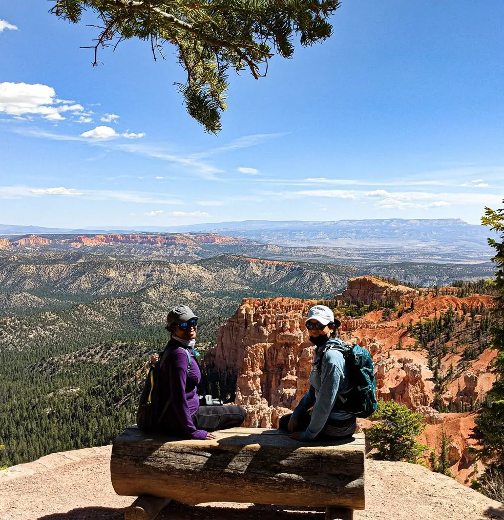
Reaching elevations of more than 9,100 feet which is around 2778 meters, the Bristlecone Loop winds through the forest atop this highest section of the park and is reachable from Rainbow Point at its southernmost point.
Here, you will see views extending into the Four Corners region and pass by 1,800-year-old Bristlecone Pines. Due to the dominance of Douglas fir, white fir, and blue spruce in the forest, grouse, woodpeckers, owls, and a variety of squirrels and chipmunks may all be found here.
13. Bryce Point Trail
- Distance: 0.3 km
- Elevation Gain: 8 m
- Estimated Time: 0h 5m
- Difficulty Level: Easy
This short, kid-friendly route leads to an overlook close to the amphitheater that offers breathtaking views of the Canyon. At the trail's southern terminus, in the paved parking area off of Bryce Point, there are two places specifically intended for accessibility.
They both have striped access aisles and are van-accessible. The first 0.01 miles of the trail are on paved concrete with railings. Usually, it is at least eight feet broad.
There is good access to the first viewpoint via the paved area beside the parking lot; but, because of the grade, it is not advised to go to the second viewpoint, which is located at 0.1 mile.
14. Sheep Creek and Swamp Canyon Loop
- Distance: 7.2 km
- Elevation Gain: 272 m
- Estimated Time: 2h 13m
- Difficulty Level: Moderate
Look into the 7.2 km circular track in the vicinity of Bryce, Utah. It takes an average of 2 hours and 13 minutes to complete and is generally regarded as a moderately hard course.
Even though this is a well-traveled hiking and walking track, there are moments during the day when you can get some peace. The months of April through November are the greatest for hiking this trek. Dogs are not permitted on this trail, so you will need to leave your puppies at home.
15. Bryce Canyon Rim Trail
- Distance: 17.2 km
- Elevation Gain: 484 m
- Estimated Time: 4h 43m
- Difficulty Level: Hard
The hikes in Bryce Canyon National Park Rim Trail offer two primary paths, the Sunrise and Sunset Points are connected by a paved trail first. The hoodoos in the vicinity may be viewed spectacularly from this easy, level walk. From Fairyland Point to Bryce Point, a considerably more challenging trail—the entire trail runs.
The flat, paved "easy" section of the path runs between Sunrise and Sunset points. Even, if you take your time, it should only take 40 minutes to complete the approximately.9-mile distance. The "moderate" section links Bryce Point and Fairyland Point as it is five and a half miles long with significant height variations.
16. Hat Shop via Under the Rim Trail
- Distance: 6.8 km
- Elevation Gain: 311 m
- Estimated Time: 2h 17m
- Difficulty Level: Moderate
The Hat Shop Trail offers peaceful seclusion and expansive views of the Grand Staircase's colorful cliffs to the south. Hikers follow the first 3.2 km of the considerably longer 37 km Under-the-Rim backcountry Trail, which descends about 457 meters before turning around and rising 3.2 km again.
Balanced-rock hoodoos are grouped along the trail's edge at the turning point. These orange pinnacles are narrow and have a distinct appearance from the hoodoos in the Bryce Amphitheater to the north.
They are topped with "hats" made of big grey stones. To camp in the wilderness along the Under-the-Rim Trail, visitors must first get a permit at the Visitor Center.
17. Yovimpa Point to Bryce Point
- Distance: 27.7 km
- Elevation Gain: 324 m
- Difficulty Level: Moderate
The moderately difficult but rewarding 27.7-kilometer point-to-point trail from Yovimpa Point to Bryce Point, near Kanab, Utah, is a great place to go cycling. Road biking and bike touring are especially popular on this route since it lets riders take in the breathtaking scenery of the area while feeling at ease.
When the weather is suitable for outdoor activities, April through October is the greatest time to explore the path. Note that dogs are not allowed on this trail, so owners of furry friends will need to find other ways to take them.
18. Riggs Spring Loop Trail
- Distance: 13.8 km
- Elevation Gain: 565 m
- Estimated Time: 4h 25m
- Difficulty Level: Hard
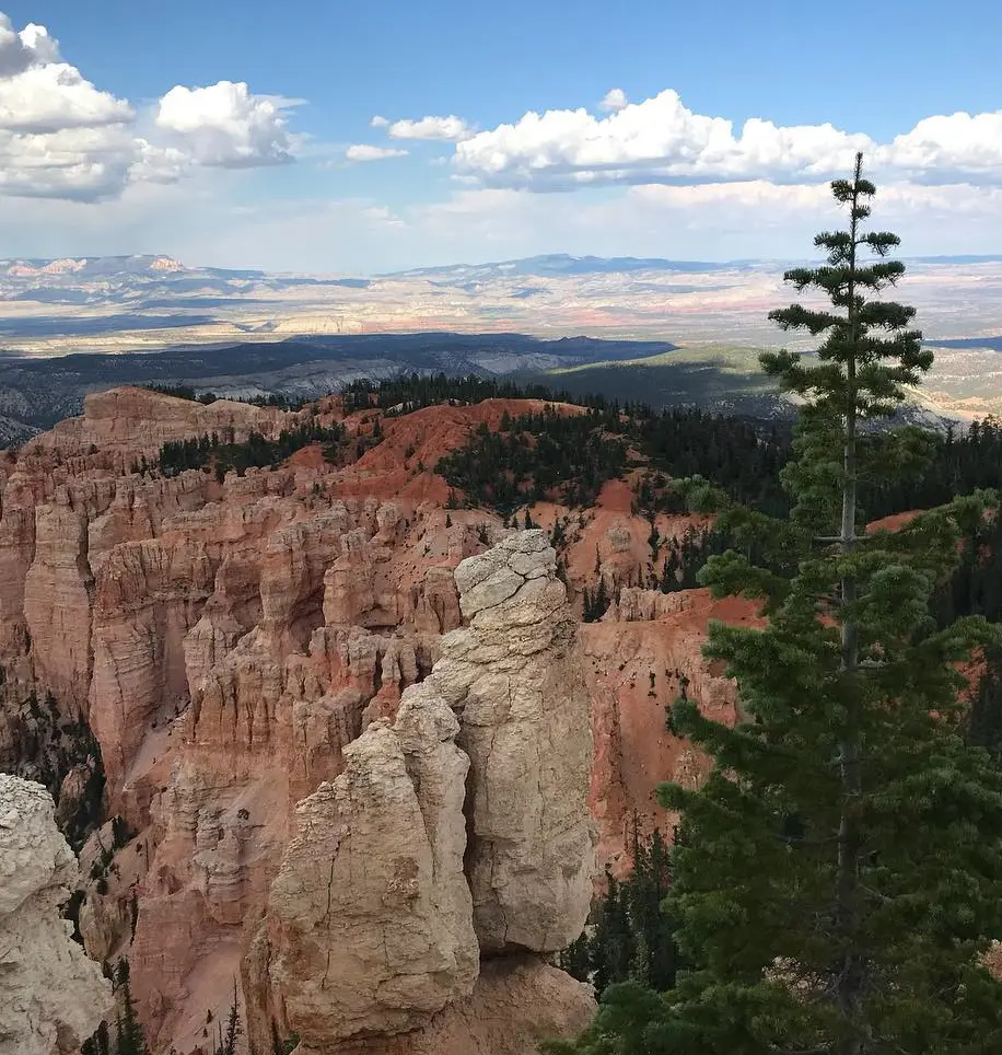
Starting at Yovimpa Point, the Riggs Spring Loop Trail winds through forests of fir, spruce, and bristlecone. The eastern side of the trail is dotted with Quaking Aspen forests and red cliff breaks, providing stunning views to the east and south. The trail's westernmost portion is steeper and has more dense woodland.
Near the halfway point of the trail is a spring that provides some much-needed shade and relief for tired hikers. It is advised that campers and hikers purify this water before consuming it. Due to the popularity of this place for backcountry camping, hikers and campers should be considerate of one another and respect each other's privacy.
19. Paria View
- Distance: 0.5 km
- Elevation Gain: 5 m
- Estimated Time: 0h 6m
- Difficulty Level: Easy
For those looking for easy outdoor exploration and beautiful views, Paria View Trail provides an enthralling experience. This little paved walk offers expansive views of the surrounding rock formations and the magnificent canyon.
The accessibility of the route is noteworthy, as it offers two parking places that are specifically designated for accessibility and a paved, smooth surface that is appropriate for people with mobility disabilities. Everyone will have a comfortable and pleasurable excursion because of the trail's gentle grade.
For those looking for somewhere to take a stroll amid breathtaking natural beauty, Paria View Trail is a great option.
20. Tropic Trail
- Distance: 5.6 km
- Elevation Gain: 169 m
- Estimated Time: 1h 35m
- Difficulty Level: Moderate
The 5.6-kilometer, fairly difficult but not so hard Tropic Trail near Bryce, Utah, provides a picturesque stroll past the area's famous red rock formations. For those looking for a serene and engrossing outdoor experience, it's the perfect option because of its moderate difficulty level and comparatively minimal traffic.
March through November are the ideal months to explore the path because of the nice weather and the most colorful scenery. Hikers are rewarded with breathtaking views of the surrounding desert's natural beauty, colorful sandstone cliffs, and towering hoodoos as they travel the trail.


