The hiking trails in Joshua Tree National Park are highly praised, as they offer a unique combination of scenic splendor, diverse terrain, and ease of access. The park's name comes from the unique Joshua trees (Yucca brevifolia), which are scattered across its landscape and add to its magnificence atmosphere.
Hidden Valley Nature Trail, Barker Dam Nature Trail, and Ryan Mountain Trail are some of the top and popular hikes and trails in Joshua Tree National Park.
1. Ryan Mountain
- Distance: 4.7 km
- Elevation Gain: 324 m
- Estimated Time: 1h 57m
- Difficulty Level: Moderate
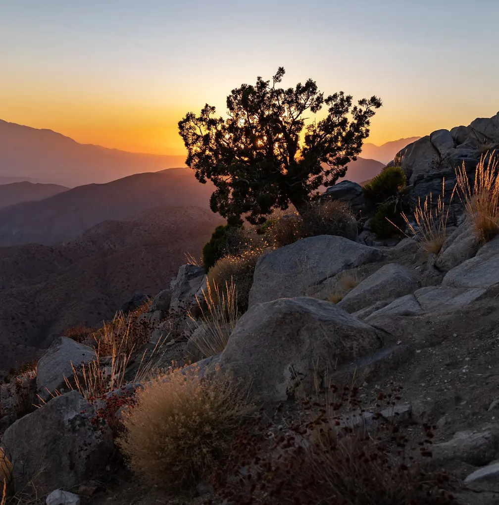
One of the most well-liked locations in Joshua Tree is Ryan Mountain, which never lets you down with its stunning scenic views over the entire area and its amazing rock formations. Hiking this route is highly recommended by visitors if you want to see an incredible sunset.
Bring plenty of water, salty snacks, and sun protection because the trek to the summit involves a fair amount of elevation increase. Hiking this trek between May and October is not advised because of the intense summer heat.
2. Hidden Valley
- Distance: 1.6 km
- Elevation Gain: 36 m
- Estimated Time: 0h 24m
- Difficulty Level: Easy
Hike this looped nature walk across the center of Joshua Tree National Park to see the best of it as it is among the top hikes Joshua Tree. Hidden Valley is a fantastic option if you only have time for one quick hike in Joshua Tree National Park. It's situated not far from Park Boulevard.
The park's well-known golden granite formations encircle this rock valley on all sides. This is not only an excellent area to hide, but it's also said that cattle rustlers from the 19th century were familiar with it and used it to hide their herds of cattle.
Interpretive panels along the nature route provide information about the local geology, wildlife, and cultural history. You might be able to see rock climbers tackling challenging routes in the area off the trail.
3. Barker Dam
- Distance: 2.1 km
- Elevation Gain: 18 m
- Estimated Time: 0h 26m
- Difficulty Level: Easy
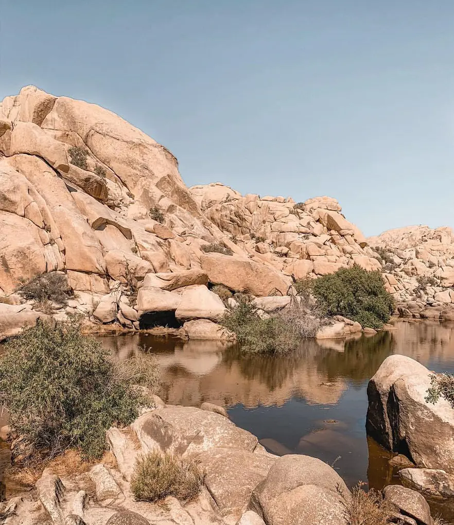
Families will love this hike, which is primarily flat with some rocky and sandy sections. This path explores some famous boulders, a rock art location, and the historic Barker Dam. Wearing suitable footwear is a good idea because this path involves some rock scrambling, albeit optionally.
A lot of Joshua trees, creosote bushes, and pinon pines can be seen along the trail, which also passes past large granite rock formations where you may watch rock climbers in action.
Owing to the desert climate, the dam is often dry, however water may be found the day after it rains or during a particularly rainy season. When the dam is filled with water, a variety of animals, including birds and bighorn sheep, are drawn to it.
4. Arch Rock Trail
- Distance: 1.9 km
- Elevation Gain: 27 m
- Estimated Time: 0h 26m
- Difficulty Level: Easy
The renowned granite Arch Rock formation may be found along the lollipop-style Arch Rock Trail, which winds over rocky and sandy terrain. Before you get to the brief circle that takes you to the Arch Rock Formation, you'll go along the Arch Rock Trail.
Hiking on this trail is advised all year round, but if you hike in the summer, it's best to begin before 9 AM. When hiking in Joshua Tree, always remember to pack lots of water, salty snacks, and sun protection.
There is parking at the Twin Tanks, also known as the Arch Rock Trailhead, for this trail. White Tank Campground only allows campers to park. Arch Rock day-use parking is prohibited at White Tank.
5. Fortynine Palms Oasis Trail
- Distance: 5 km
- Elevation Gain: 194 m
- Estimated Time: 1h 33m
- Difficulty Level: Moderate
On this hike, experience granite ridges, sandy washes, rolling terrain, and breathtaking views. It will also allow you to descend down into a gorge and explore a secluded oasis of fan palms. There are several challenging parts of this trip that go up and over peaks and descend into canyons.
You will find the trailhead by turning onto a little dirt road that comes off of Twenty Nine Palms Highway. For species, the oasis itself offers vital habitat and a water source. The oasis itself is closed to the public in order to protect the wildlife, so please heed any posted notices and stick to the trail in this area.
There is hardly much cover on this trail, and mobile connection is unreliable. Hiking this trek in hot weather conditions, particularly from May to October, is not advised.
6. Panorama Loop
- Distance: 10.1 km
- Elevation Gain: 364 m
- Estimated Time: 3h 4m
- Difficulty Level: Moderate
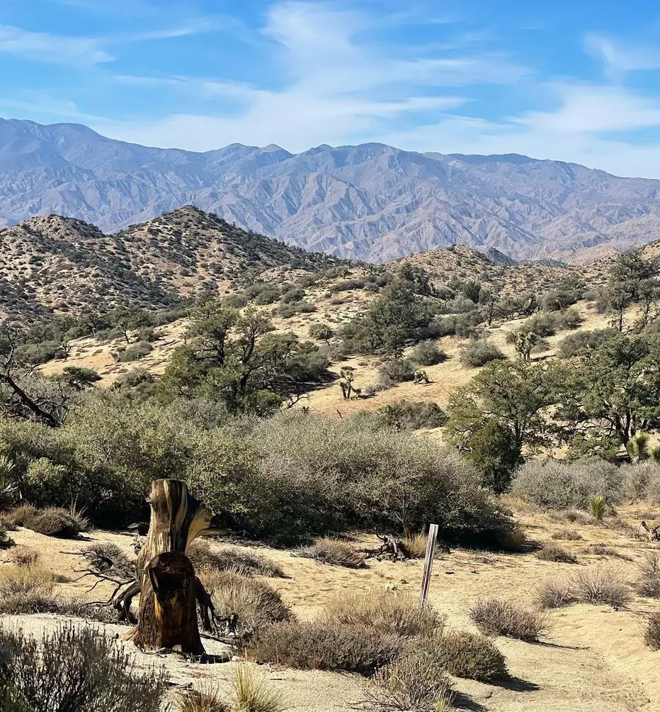
The Panorama Loop Trail offers some of the most fascinating higher-elevation vegetation and some of the most breathtaking views in Joshua Tree National Park. The trailhead is located at an elevation of roughly 4000 feet. Before ascending a ridge and touring the Little San Bernadino Mountains, you will hike along a sandy wash.
The trail is in the northwest corner of the park, directly outside Black Rock Campground. In comparison to the park's lower elevation areas, there are more Joshua trees, Pinyon pines, and Juniper trees there, as well as significantly lower temperatures.
7. Split Rock Loop
- Distance: 3.9 km
- Elevation Gain: 84 m
- Estimated Time: 0h 58m
- Difficulty Level: Easy
This loop hike offers views of the desert, wildlife, and rock formations in one go, so you can complete the loop either way, but don't forget to add an extra mile to visit Split Rock and Face Rock and winter is the ideal time of year to climb this trail.
Take extra care when hiking in the scorching desert if you do choose to hike this route in the summer. Starting early (before 9 AM) and packing lots of water, snacks or energy bars, and sun protection are all wise decisions. Download your map in before the hike because there isn't any dependable mobile coverage in the park.
8. Skull Rock
- Distance: 2.7 km
- Elevation Gain: 45 m
- Estimated Time: 0h 38m
- Difficulty Level: Easy
Although this nature path loop covers boulder piles, desert washes, and of course the eponymous Skull Rock, it is also possible to observe Skull Rock from the road and this trail has a few tight, steep portions.
You can start this trail inside Jumbo Rocks Campground, across from the amphitheater, or right across the campground's entrance. The enormous granite boulder known as Skull Rock has hollowed-out eye sockets that were created over time by water eroding tiny crevices in the rock.
9. Lost Palms Oasis
- Distance: 11.9 km
- Elevation Gain: 319 m
- Difficulty Level: Moderate
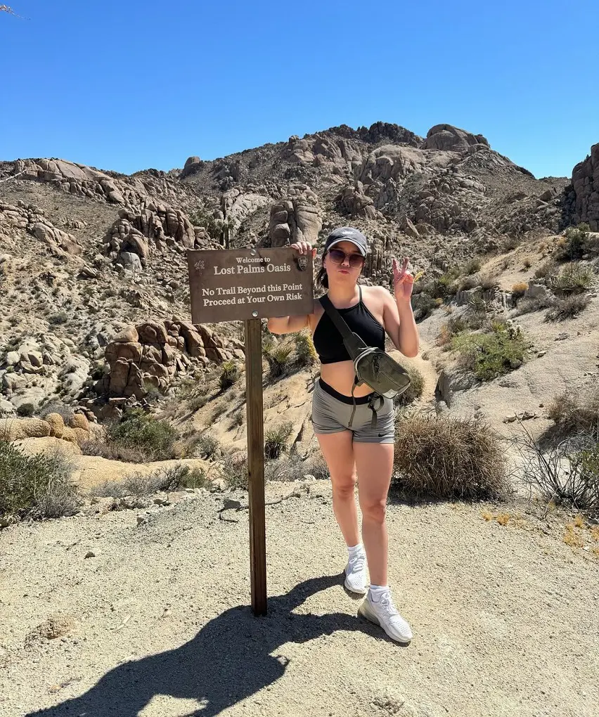
Joshua Tree National Park's southern border is home to the Lost Palms Oasis Trail. Because of the lower altitude, there aren't many Joshua Trees in the area, but there is a beautiful palm tree grove inside a desert oasis. This route is a fantastic place to see the night sky.
It's a strenuous scramble off-route to reach the oasis. Because of the intense heat, hiking this trek between May and October is not advised. Although the Cottonwood Visitor Center is located only up the road, there are no restrooms at the trailhead.
Backpackers can self-register for overnight hiking trips in the region at the Cottonwood Spring Wilderness Hiking Board, which is situated at the trailhead.
10. Cholla Cactus Garden
- Distance: 0.3 km
- Elevation Gain: 3 m
- Estimated Time: 0h 4m
- Difficulty Level: Easy
The Cholla Cactus Garden is situated close to the area where the Colorado and Mohave Deserts converge on Pinto Basin Road. The damp conditions of the area allow for a significant concentration of cacti. There is a loop walk to explore the Cholla Cactus Garden.
These cacti are known as "jumping" chollas because their segments can break off and attach to humans and animals to reproduce. Use caution when near these cacti. In this location, it's best to stick to the route and wear closed-toe footwear.
11. Hall of Horrors
- Distance: 1 km
- Elevation gain: 8 m
- Difficulty Level: Easy
Hiking this trail allows you to explore many rock formations and stacks of boulders that give the area its title, "Hall of Horrors." This is a well-liked location on Park Boulevard, midway between Ryan Campground and Sheep Pass Group Campground.
The two primary groups of rock formations in the area are hiked through on this plotted route, although side routes allow you to explore some other rock formations. The Hall of Horrors offers plenty of chances for climbing and exploring, making it an excellent destination for families with young children.
This region offers numerous picturesque vistas and is encircled by mountains. Although there is no technical climbing involved in this route, the Hall of Horrors is a well-liked spot for technical rock climbing.
12. Mastodon Peak
- Distance: 3.9 km
- Elevation Gain: 124 m
- Difficulty Level: Easy
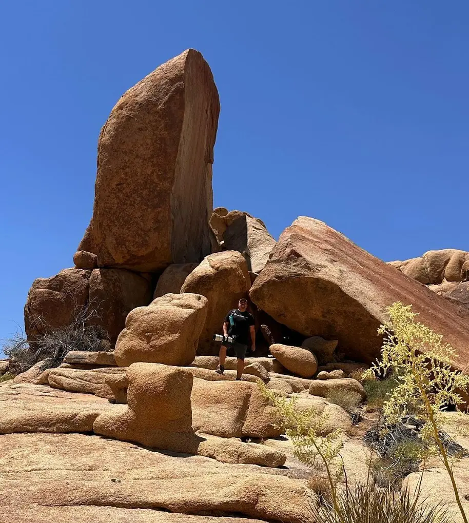
You will reach the summit of Mastodon Peak using this loop and need to undertake a scramble to reach the top of the rugged granite peak. Following the peak, the path passes by an abandoned gold mine. Along the way, you should anticipate seeing a lot of fascinating desert flora.
The Salton Sea is visible from the top on clear days and winter time is the ideal time of year to hike this trail. Take extra care when hiking in the scorching desert if you do choose to hike this route in the summer.
13. Lost Horse Loop
- Distance: 10.3 km
- Elevation Gain: 254 m
- Estimated Time: 2h 42m
- Difficulty Level: Moderate
A more sedate and serene way to see the ancient Lost Horse Mine is along this walk. The hike offers a wonderful mix of different types of terrain, with particularly nice views to the east immediately after crossing the mine. There is hardly much cover on this trail, and mobile connection is spotty.
Hiking this trek in the summer or any other hot weather conditions is not advised. Although the trailhead's access road isn't paved, most cars should be able to drive on it. When it snows during the winter, the main road leading to the trailhead may periodically close.
14. Wall Street Mill
- Distance: 2.9 km
- Elevation Gain: 23 m
- Estimated Time: 0h 35m
- Difficulty Level: Easy
The historic Wall Street Mill site is reached by hiking this route as there is not much elevation gain on the route, and you can stop along the way to see Joshua trees and intriguing rock formations. In the past, this mill processed gold extracted from nearby mines.
This location is steeped in local history and local folklore. Don't overlook the homestead and rusting cars. Please leave all artifacts for enjoyment by future guests. Parking is available at a gravel lot off Queen Valley Road, directly east of the Barker Dam Trailhead.
This trail also has a longer variation that starts at a different parking lot. This alternative variation can be started from the Barker Dam Loop trailhead's paved parking area.
15. Warren Peak
- Distance: 9 km
- Elevation Gain: 337 m
- Estimated Time: 2h 46m
- Difficulty Level: Moderate
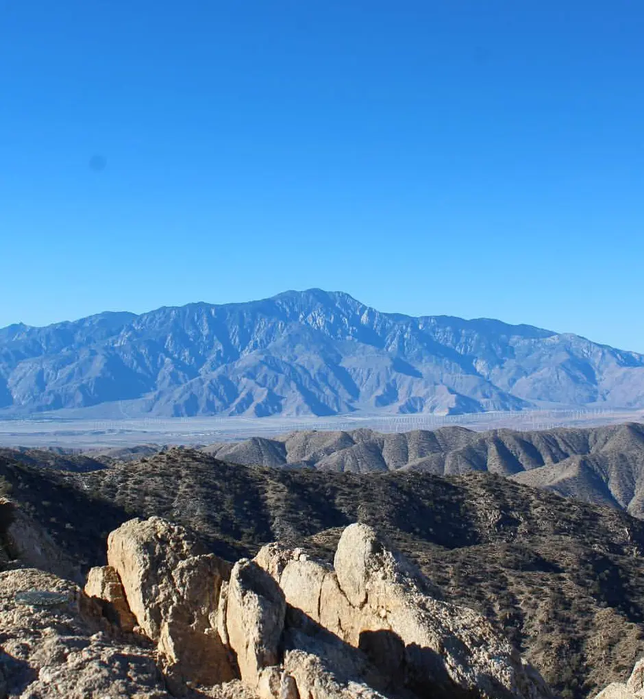
By following the Black Rock Canyon Trail, you can reach the summit of Warren Peak using this route. Start at the backcountry board and trailhead at Black Rock Canyon. This path provides sweeping vistas of Joshua Tree National Park's tranquil western region.
There is hardly much cover on this trail, and mobile connection is spotty. It is not advised to trek this trail in hot weather or between May and October.
16. Willow Hole
- Distance: 10.9 km
- Elevation Gain: 74 m
- Estimated Time: 2h 11m
- Difficulty Level: Moderate
You can hike along the Wonderland of Rocks' edge on this walk. Along the way, you'll pass through sand washes, intriguing rock formations, and forests of Joshua trees. The walk ends at Willow Hole, a marshy region dotted with willows.
There is hardly much cover on this trail, and mobile connection is very unstable and unreliable. It is not advised to trek this trail in hot weather or between May and October. Checking the weather and downloading your map in advance are also smart ideas before you leave.
17. Lost Horse Mine
- Distance: 6.6 km
- Elevation Gain: 161 m
- Estimated Time: 1h 43m
- Difficulty Level: Moderate
One of the park's most prosperous gold mines, the Lost Horse Mine, is accessible via this walk along the former mine wagon road. The trailhead is off Keys View Road at the end of the dirt Lost Horse Mine Road. The trail you'll be on is mainly level with occasional rough areas.
As a reward, you'll have a fantastic view of Pinto Basin. To preserve the historic place, kindly remain outside the enclosed area. Winter is the ideal time of year to climb this trail. Take extra care when hiking in the scorching desert if you do choose to hike this route in the summer.
18. High View Trail
- Distance: 2.3 km
- Elevation Gain: 102 m
- Estimated Time: 0h 45m
- Difficulty Level: Moderate
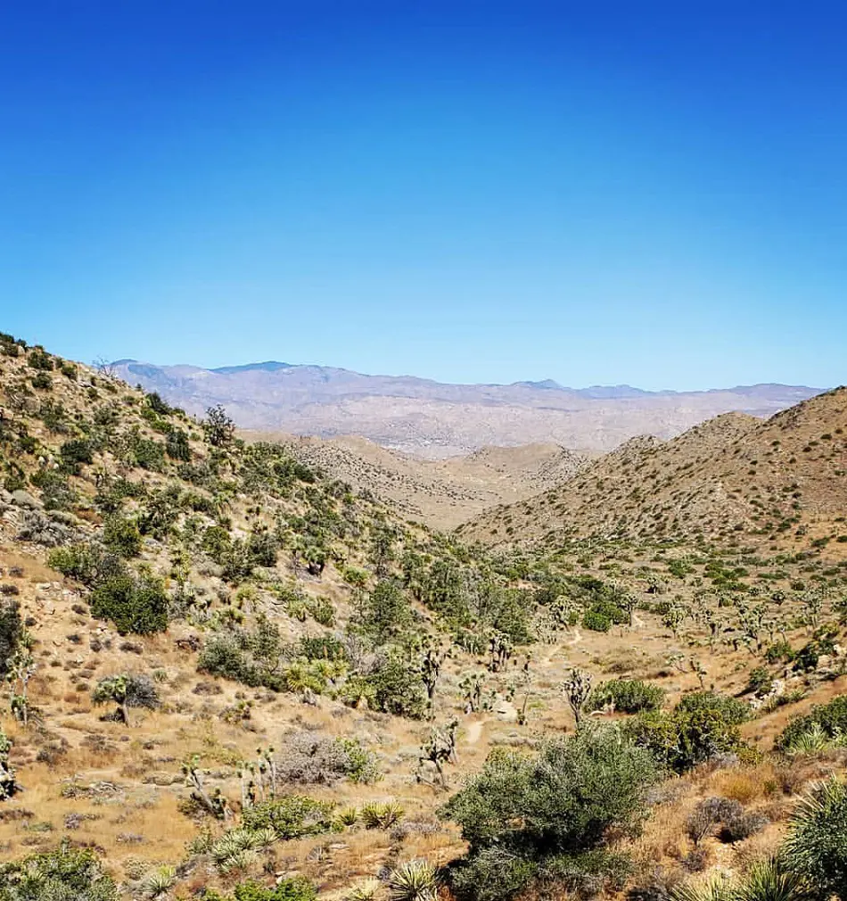
Large Joshua trees, pinyon pines, and juniper trees are all along the High View trail as it leads to a ridge on the park's western edge. There are multiple benches to stop and take in the expansive views of the surroundings, as well as some steep areas.
Located at the perimeter of the park, northwest of Black Rock Campground is the Hi-View trailhead, accessible by a dirt road. There is a mixture of rock, dirt, and sandy washes on the trail. There is hardly much cover on this trail, and mobile connection is very poor.
Starting your hike before 9 AM is ideal if you're going during the summer. When trekking in Joshua Tree, don't forget to pack water, salty snacks, and sun protection.
19. The Maze Loop
- Distance: 7.9 km
- Elevation Gain: 114 m
- Difficulty Level: Moderate
This loop leads to The Maze, a jigsaw puzzle of rock formations and stacks of boulders situated amid a desert scrub landscape. The Maze portion of this path is much what its name implies: it could be simple to get lost.
Although there are cairns to guide you along the trail in this stretch, navigating between the steep rock walls, canyons, and boulders can occasionally be challenging. If you opt to explore the region off-trail and scramble, it might be particularly simple to become lost.
Look for the Window Rock formation on your return trip to the trailhead after you exit the Maze area. The journey back involves portions of a wide sandy wash and a largely level desert floor.
20. Discovery Trail
- Distance: 1.1 km
- Elevation Gain: 21 m
- Estimated Time: 0h 16m
- Difficulty Level: Easy
Through the Face Rock Trail, this loop links the Split Rock Loop and Skull Rock trails. You'll pass through desert washes and mounds of boulders on this stroll. The surface of this trail is rough dirt and there are tight passages, steep inclines, as well as stairs. There is space for car, van, and RV parking at the trailhead.
All year-round hiking is advised on this trail as it is one of the best hikes in Joshua Tree National Park, and it's a good idea to start early in the summer. Hiking in Joshua Tree requires bringing lots of water, salty snacks, and sun protection, even though this trek is less than a mile long.


