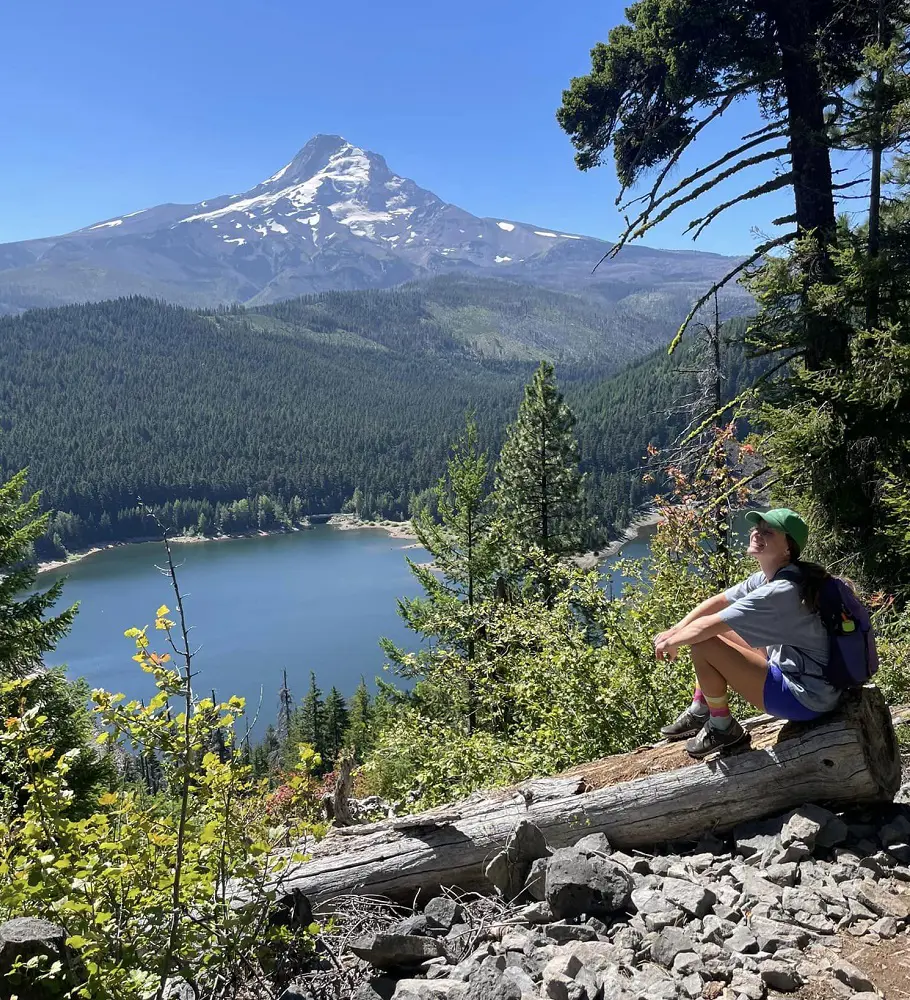
Portland, Oregon, also known as the "City of Roses," has a wide range of hiking trails that are suitable for hikers of all experience levels. Portland, perfectly situated for hiking between the Oregon Coast and the Cascade Range, has astonishing scenery.
Forest Park, which is one of the largest urban forests in the U.S. has the best trails and hikes in Portland, as it offers around eighty miles of trails, the Wildwood Trail is among the popular ones. The Pittock Mansion and Mount Hood are some of the trails that provide a mixture of nature and city views.
1. Lower Macleay Park to Pittock Mansion
- Distance: 7.9 km
- Elevation Gain: 271 m
- Route Type: Out & back
- Estimated Time: 2 hours 20 minutes
- Difficulty Level: Moderate
An average of two hours and twenty minutes is needed to complete the Lower Macleay Park to Pittock Mansion course, which is typically regarded as fairly hard. Track down Pittock Mansion to get a bird's-eye view of Portland. The trail offers fantastic views of the city and is primarily wooded.
Spend some time exploring the grounds of the Pittock Mansion when you get there. One of the most powerful families in Portland owned the Pittock Mansion when it was constructed in 1914. The route is lovely to explore at any time of year and is open year-round. Dogs are allowed, but they need to wear leashes.
2. Pittock Mansion via Upper Macleay and Wildwood Trail
- Distance: 4.2 km
- Elevation Gain: 150 m
- Route Type: Loop
- Estimated Time: 1 hour 15 minutes
- Difficulty Level: Easy
The 4.2-kilometer Pittock Mansion through Macleay and Wildwood Trail loops around Portland, Oregon. It takes an average of one hour and fifteen minutes to complete and is typically regarded as an easy route. This loop leads to the Pittock Mansion site via Forest Park.
As previously mentioned, the mansion was constructed in 1914 for Henry Pittock and his wife, Georgiana Burton Pittock. You will travel through a lush forest of trees coated in moss to get to the mansion. The home offers a lovely view of Mount Hood and downtown Portland. They let's dogs on this trail but only if they are on a leash.
3. Wildwood and Redwood Trail Loop
- Distance: 4.2 km
- Elevation Gain: 108 m
- Route Type: Loop
- Estimated Time: 1 hour 6 minutes
- Difficulty Level: Easy
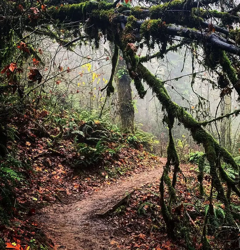
Situated not far from Portland, a peaceful path leads to the Hoyt Arboretum, often known as the Living Museum of Trees. This fascinating location is distinguished by its lush, verdant surroundings, which include a densely forested area that provides both expansive views of Portland's skyline and magnificent views of the surrounding countryside.
One of the highlights of the trip is the stunning viewpoints found along the trails themselves. There are some mild inclines on the trail, and muddy road conditions can be found in some places, especially in the rainy season.
4. Washington Park Loop
- Distance: 5.5 km
- Elevation Gain: 126 m
- Route Type: Loop
- Estimated Time: 1 hour 24 minutes
- Difficulty Level: Easy
This route connects all the main locations and points of interest in the area by tracing the most well-liked and stunning paths in Washington Park. Portland's famous Rose Test Gardens, the Zoo, and gorgeous Japanese Gardens are all included in this family-friendly tour.
Visitors will pass via a stretch of the Wildwood Trail, which is among Washington Park's top trails overall. There are plenty of other side routes that let you explore the surrounding area. If leashed, dogs are allowed on the trail.
5. Tryon Creek Triple Bridge Loop
- Distance: 5.5 km
- Elevation Gain: 163 m
- Route Type: Loop
- Estimated Time: 1 hour 32 minutes
- Difficulty Level: Moderate
The Tryon Creek Triple Bridge Loop path is located close to Portland, Oregon. It's regarded as a moderately difficult route, taking an average time of 1 hour 32 minutes to finish. The route is lovely to explore at any time of year and is open year-round and they allow dogs too, but they need to wear leashes.
This walk winds through the beautiful urban preserve, over three bridges, and passes through woods, yet it's only a short drive from Portland's downtown. This hidden gem of a park has some paths, one of which is this loop that takes hikers on a several-mile walk through a Pacific Northwest rainforest covered in moss.
6. Hoyt Arboretum Trails
- Distance: 2.3 km
- Elevation Gain: 66 m
- Route Type: Loop
- Estimated Time: 38 minutes
- Difficulty Level: Easy
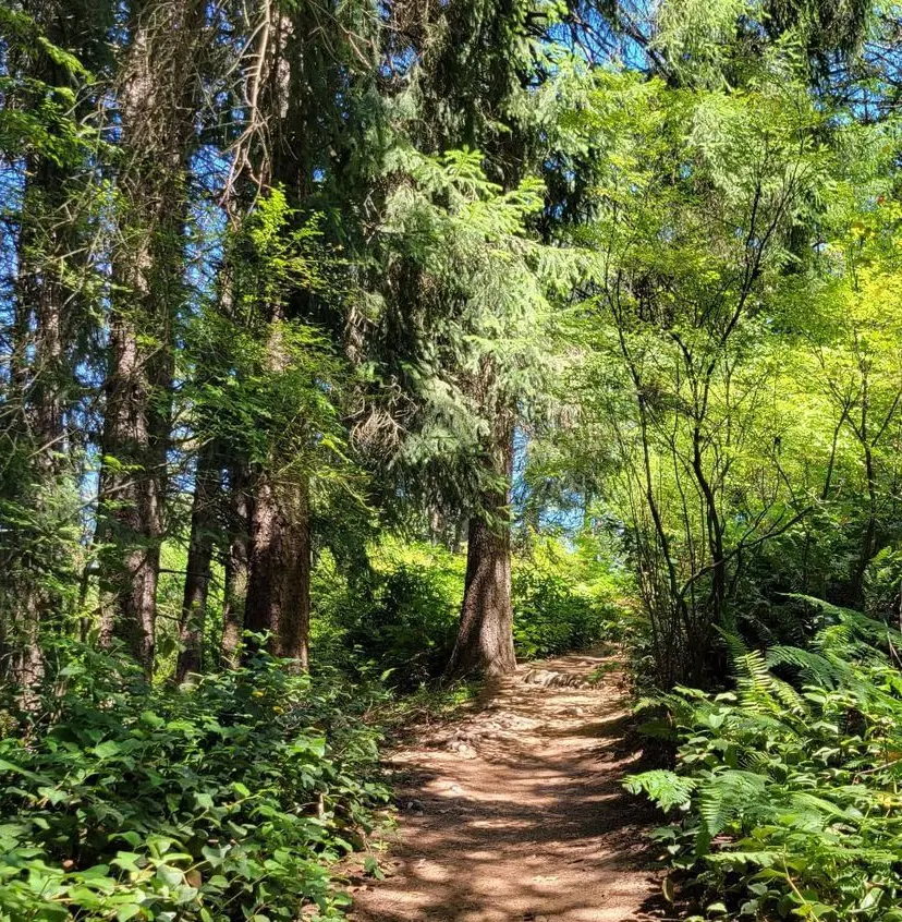
This is just one of many paths in Hoyt Arboretum that you may easily extend or shorten to suit your own walking needs. This walk, which winds through the gardens and tree groves, is ideal for the whole family. When the leaves are turning in the autumn, it is quite striking.
There are plenty of benches for resting along the route, and the redwood deck provides fantastic views. Every day from 5 am to 10 pm throughout the year, the grounds are free to use for the general public.
7. Council Crest via Marquam Trail
- Distance: 5.6 km
- Elevation Gain: 246 m
- Route Type: Out & back
- Estimated Time: 1 hour 50 minutes
- Difficulty Level: Moderate
This hike across Portland's West Hills begins at the base of Marquam Nature Park and offers a substantial elevation rise over adjacent three-mile excursions. While there are a few short portions with less height gain, you will be trekking on steep hills for the most part.
The Marquam Trail has plenty of trail markers and signage at each intersection, and it is kept up nicely. The majority of the route follows ridgeline paths that hug small wetlands, rivers, and ravines, all the while providing vistas of Portland's massive urban forest.
8. Mount Tabor: Main Loop
- Distance: 3.1 km
- Elevation Gain: 65 m
- Route Type: Loop
- Estimated Time: 45 minutes
- Difficulty Level: Easy
This city park is home to three separate historic reservoirs for Portland. The whole family will enjoy the picnic spaces, dog park, monuments, public art, tennis and volleyball courts, and public art in this park. Above the amphitheater are restrooms and a tiny visitor center.
At the north terminus of the route, in the paved parking area off Southeast Salmon Way, are designated accessible places. They have striped access aisles and are van-accessible. The asphalt trail surface is smooth and paved. It usually has several broader passing places and is 4 to 8 feet wide. For parts of the trip, there is a bike lane on the side of the road.
9. Forest Park Ridge Trail
- Distance: 6.4 km
- Elevation Gain: 260 m
- Route Type: Out & back
- Estimated Time: 2 hours
- Difficulty Level: Moderate
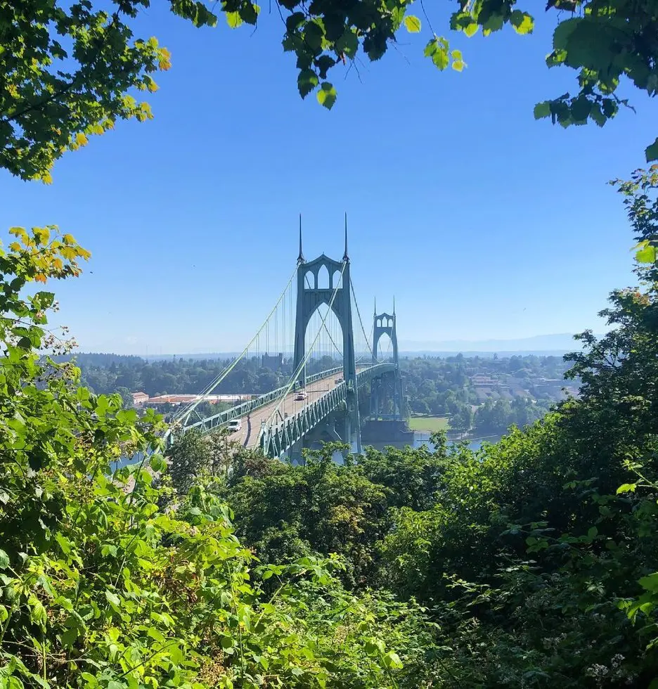
Start by traveling slightly more than half a mile on Northwest Firelane 7 Road. You will come to a designated intersection with the Ridge Trail at this point. You'll follow the ridge downhill in the direction of Northwest Bridge Avenue.
You can enjoy stunning views of the Willamette River and the St. John's Bridge from this location. With an average completion time of two hours and thirty minutes, this trail is typically regarded as fairly tough. The route is lovely to explore at any time of year and is open year-round. Dogs are allowed, but they need to wear leashes.
10. Balch Creek and Wildwood Trail
- Distance: 8.0 km
- Elevation Gain: 238 m
- Route Type: Loop
- Estimated Time: 2 hours 15 minutes
- Difficulty Level: Moderate
Hiking in Portland, Oregon's Balch Creek and Wildwood Trail loop is a well-liked recreational activity for those seeking a picturesque yet somewhat strenuous hike. Hikers begin at the Lower Macleay Trailhead, travel beside Balch Creek, and then climb the Wildwood Trail.
Connectivity is provided by the Birch Trail, which leads to NW 53rd Dr. Hikers can reach Holman Lane by taking a short stroll along the road. After passing through a gate, they descend the slope and eventually re-join the Wildwood Trail.
Dogs are allowed on the route, but they must be kept under control with a leash on, to protect everyone's safety and enjoyment.
11. Marquam, Towhee, Flicker & Warbler Loop
- Distance: 6.6 km
- Elevation Gain: 287 m
- Route Type: Loop
- Estimated Time: 2 Hours 10 minutes
- Difficulty Level: Moderate
In the center of Portland, the 6.6-kilometer Marquam, Towhee, Flicker & Warbler Loop provides a moderate hiking experience with a 287-meter elevation gain. This scenic circuit, usually finished in two hours and ten minutes, is perfect for people looking for a peaceful time away from it all.
For walkers of all ability levels, the trail's varied terrain, which includes lush forests, gradual climbs, and expansive vistas—offers an enthralling experience. It is significant to emphasize that bikes are not allowed on this trail, guaranteeing that all visitors will experience a tranquil and pedestrian-friendly setting.
12. Dogwood and Wild Cherry Loop
- Distance: 3.9 km
- Elevation Gain: 153 m
- Route Type: Loop
- Estimated Time: 1 hour 15 minutes
- Difficulty Level: Moderate
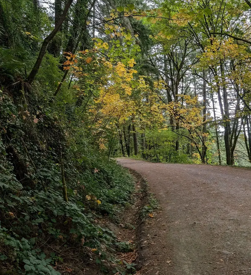
Portland's 3.9-kilometer, moderately challenging Dogwood and Wild Cherry Loop provides a peaceful hiking experience. The well-kept paths offer a pleasant walking experience because of their breadth and obvious signage.
While the ground may be muddy and slick, particularly after rain, it is advised to wear shoes with high traction. Along the trail is a handy bench for anyone looking for a quick break. Furthermore, outhouses are accessible around midway on the loop, guaranteeing hiker convenience.
13. Skyline Cruise Loop Trail
- Distance: 4.7 km
- Elevation Gain: 153 m
- Route Type: Loop
- Estimated Time: 1 hour 20 minutes
- Difficulty Level: Moderate
In the center of Portland's natural environment, the Skyline Cruise Loop Trail, a blend of fire roads and the Wildwood Trail offers a dramatic and engrossing experience. The heavily forested area, with its tall, moss-covered trees and lush, fern-covered forest floor, elicits a serene, enchanted mood.
On clear days, hikers are rewarded with spectacular views of Mount Rainier and Mount Saint Helens, especially from the power line clearcut. Nature lovers get the perfect chance to appreciate the natural world and the splendor of the Pacific Northwest on this lovely walk.
14. Oaks Bottom Wildlife Refuge Loop
- Distance: 5.0 km
- Elevation Gain: 67 m
- Route Type: Loop
- Estimated Time: 1 hour 10 minutes
- Difficulty Level: Easy
This loop around Oaks Bottom Wildlife Refuge offers a pleasant stroll through a bird-rich wetland, culminating in a return along the Willamette River. Only the paved portion of this Willamette River trail is open to bicycles; the dirt sections are off-limits. This is an excellent location for observing birds.
Following a path along the eastern edge of a wetland region, you might spot some Flycatchers or perhaps ospreys that are close to their nests. You will turn at the northern parking area and take the lovely Springwater bike trail back. To safeguard these delicate ecosystems, dogs must be kept on a leash at all times.
15. Marquam and Flicker Trail Loop
- Distance: 2.9 km
- Elevation Gain: 91 m
- Route Type: Loop
- Estimated Time: 50 minutes
- Difficulty Level: Moderate
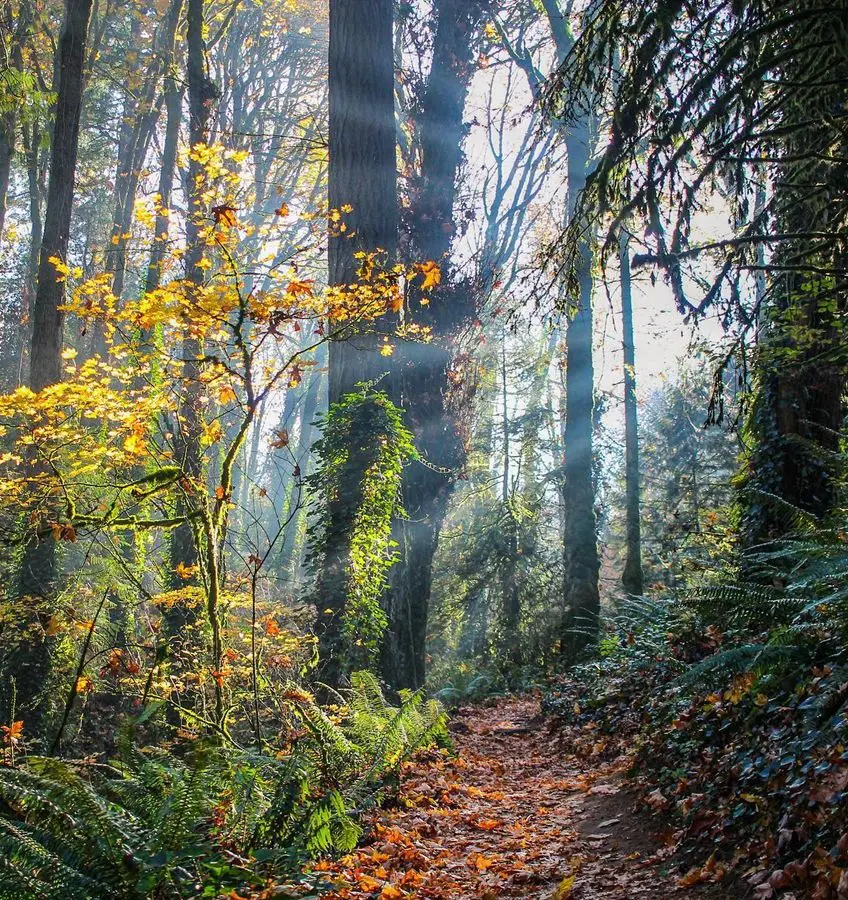
There's lots of signage throughout this gorgeous woodland trail in Marquam Nature Park to help you stay on course. The route meanders through wildlife-rich, tranquil woodlands. Parking is available along Southwest Terwilliger Boulevard.
From this point on, the trail ascends gradually along Marquam Trail before descending sharply along Flicker Trail. The hike takes about 50 minutes to complete and is somewhat strenuous. It's best to visit this trail between January and November for the best results.
16. Keil Loop Trail
- Distance: 4.0 km
- Elevation Gain: 110 m
- Route Type: Loop
- Estimated Time: 1 hour 6 minutes
- Difficulty Level: Easy
The 4-kilometer Keil Loop Trail is a tranquil getaway into the outdoors that is located close to Portland, Oregon. This track is comparatively easy and great for hikers, runners, and walkers. It winds through a beautiful forest with tall trees and a dense undergrowth.
All fitness levels can access the trail due to its well-kept trails and clear signs. Peak hours may see increased traffic, but the Keil Loop Trail is still a peaceful haven where you can get back to nature and take in the splendor of the Pacific Northwest.
17. Old Main Trail Loop
- Distance: 1.9 km
- Elevation Gain: 45 m
- Route Type: Loop
- Estimated Time: 30 minutes
- Difficulty Level: Easy
People frequently visit the Tryon Creek State Natural Area's Old Main Trail Loop to take in the scenery while taking walks with their dogs or stretching their legs. It's a good idea to keep an eye on the map if you're attempting to stick to a specific path because the lovely network of trails has a lot of crossings.
Nearly the whole trail is shaded, and there are rest areas and seats to enjoy the scenery along the route. There are lovely restrooms and parking at the Nature Center, which is also where the route starts.
18. Portland River Loop Trail
- Distance: 17.5 km
- Elevation Gain: 98 m
- Route Type: Loop
- Estimated Time: 3 hours 25 minutes
- Difficulty Level: Easy
This is a river loop that crosses both the North Steel Bridge and the Sellwood Bridge. At the east end of the route, in the paved parking lot off Southeast Water Avenue, four places are certified as accessible. They are all van-accessible and have access aisles that are striped.
The route is smooth, made of either asphalt or concrete, and it usually measures at least six feet in width. For a portion of the trail, the route uses a bike lane on the side of the road that is designated by a painted line.
19. MAX to MAC
- Distance: 6.1 km
- Elevation Gain: 161 m
- Route Type: Loop
- Estimated Time: 1 hour 40 minutes
- Difficulty Level: Easy
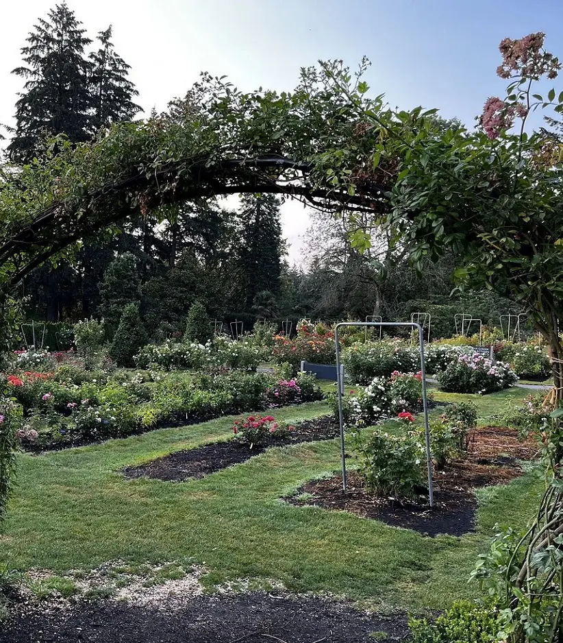
This loop connects the Mac Trail to the MAX and starts at the western entrance to the Washington Park MAX station. Some of Hoyt's most prominent attributes, such as a large amount of forest, plant interpretation, and gardens and monuments honoring veterans, will be visible to you.
Along this route, there are lots of locations to fill up with water and public restrooms at the Rose Gardens. Trailhead parking is pay-and-park; for a more environmentally friendly way to finish this trip, take the fantastic MAX metro from either the west or the east, using the Red or Blue Lines to the Washington Park station.
From central Portland, taking the MAX is a relatively simple, quick, and affordable option.
20. North Horse Loop
- Distance: 3.2 km
- Elevation Gain: 79 m
- Route Type: Loop
- Estimated Time: 50 minutes
- Difficulty Level: Moderate
The Tyron Creek Nature Center Parking Lot, which has water refill stations and facilities, is where the North Horse Loop starts. For this one, you'll want to make sure you stay on course by frequently consulting your map.
Numerous turnoffs are optional. The route has a modest elevation rise and travels along lovely, open paths. For much of the trip, the walkway is well-lit. There are lots of fern-filled gullies, mushrooms, and various plants to admire in the forest beauty throughout the route.


