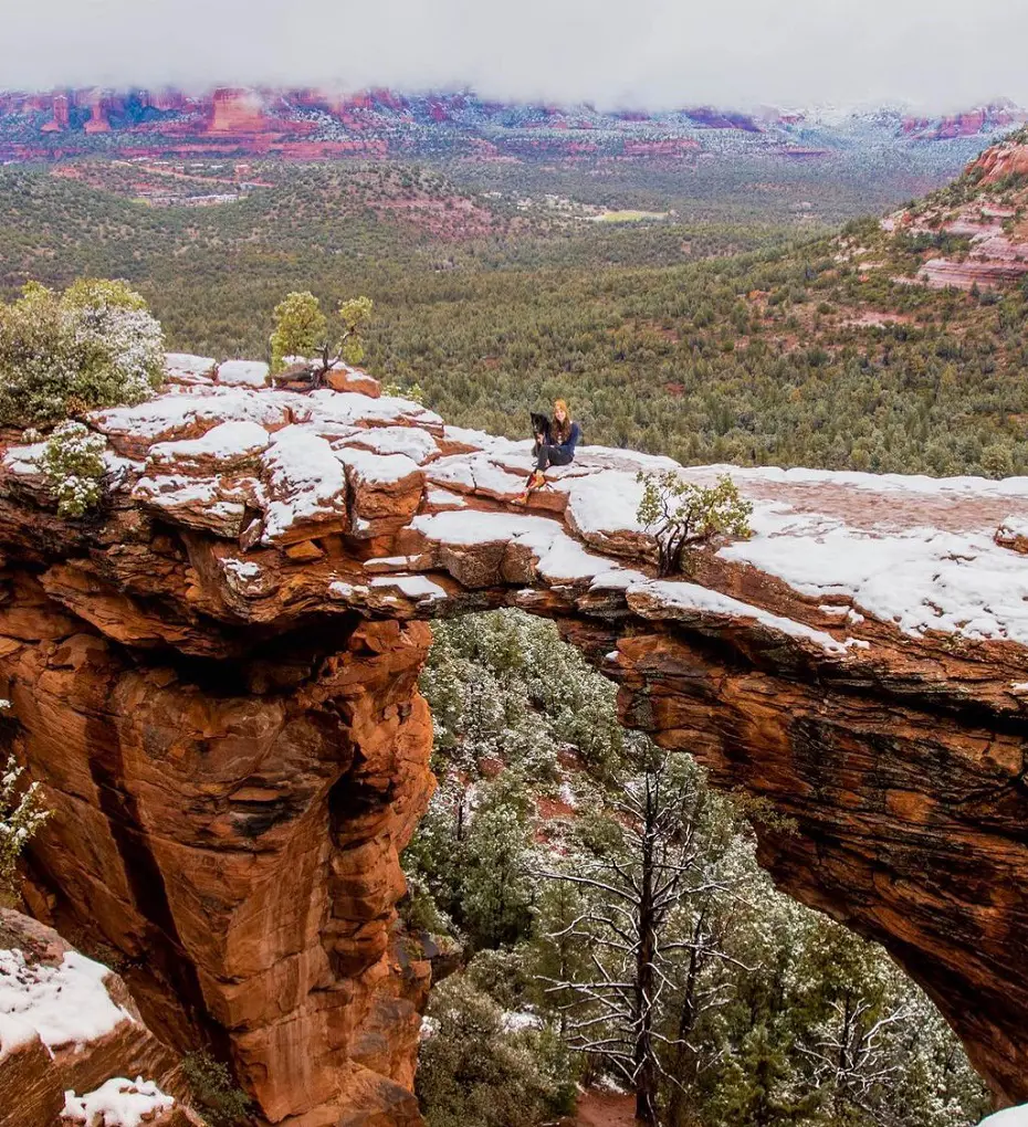
Hiking trails are plentiful in Sedona, Arizona, which is known for its spiritual aura and striking red rock formations. Devil's Bridge, an impressive sandstone arch, and Cathedral Rock, a spectacular rock formation, are two of the most well-known.
Boynton Canyon Trail offers views of hidden waterfalls and meanders through lush greenery for those, looking for a more serene experience.
Climbers who are up for a challenge can ascend Bell Rock and hikers who follow the Seven Sacred Lakes trek are rewarded with stunning views and crystal-clear lakes. Together, these trails, each with a distinct charm help Sedona maintain its standing as a top hikes in Sedona.
1. Devil's Bridge Trail
The hike begins on the Chuck Wagon walk and then follows a connecting path that offers beautiful landscapes and amazing views. The trip ends at Devil's Bridge, a well-known sandstone arch valued for its picturesque traits. It is one of the best places to hike in Sedona.
There is free parking at the Dry Creek Vista Trailhead, but it fills up quickly and has a restricted capacity. As a result, it is advised to arrive early. Alternatively, guests can reach the Dry Creek Vista trailhead using the free park-and-ride service provided by the Sedona Shuttle.
- Difficulty Level: Moderate
- Distance: 9.2 km
2. Cathedral Rock Trail
There are two parking lots close to the Cathedral Rock trailhead, which is located close to Back'O'Beyond Road. Hikers are required to use the Sedona Shuttle service to get to the trailhead during this time. The Baldwin and Templeton paths are another way to get to the route.
The climb to the summit requires traversing exposed rock surfaces, thus good shoes are a must, as is using your hands for balance. Despite the trail's modest length, maintaining the proper route requires paying attention to the indicated cairns. The hike usually takes half an hour to an hour and a half each way. It is strongly discouraged to bring dogs due to the terrain.
- Difficulty Level: Hard
- Distance: 1.9 km
3. Boynton Canyon Trail
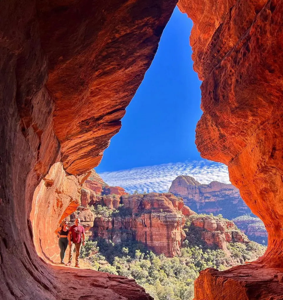
Boynton Canyon is a popular hiking location close to Sedona. The trail is especially popular in the fall when the vivid yellow foliage makes a striking contrast with the canyon walls. It is well-known for its stunning views of the surrounding desert countryside and the canyon floor.
The canyon is a desirable option because of its cooler, shaded atmosphere, particularly in the warmer summer and shoulder seasons. It is advised to arrive early to guarantee parking availability and more comfortable temperatures. It is for sure one of the cool hikes in Sedona.
- Difficulty Level: Moderate
- Distance: 11.6 km
4. Seven Sacred Pools via Soldier Pass
Among the cool hikes in Sedona, this trail features some of the most fascinating features of the area and provides amazing views. Hikers are urged to pack plenty of water and sunscreen because there isn't much shade along the course.
If there are too many people at the marked trailhead, there are other places to begin your adventure. The loop can be completed either way, and a detour to the mesa is an optional option for those looking for more difficulty and elevation gain. The hike usually takes more than two and a half hours.
- Difficulty Level: Moderate
- Distance: 9 km
5. Seven Sacred Pools and Soldiers Pass Cave Trail
Although it is a priceless archeological site, this region needs to be carefully maintained. Its visitors are respectfully asked to follow certain rules to protect its fragile ecosystems and cultural legacy. Please stick to approved pathways for your investigation to cause as little disruption as possible to the delicate plants and cryptobiotic soil.
To guarantee the long-term preservation of this place, it is essential to adhere to the Leave No Trace philosophy. You help ensure that this priceless resource is preserved for future generations by adhering to these rules.
- Difficulty Level: Moderate
- Distance: 4.8 km
6. Soldier Pass Trail

Sedona's Soldier Pass is a widely recognized hiking destination known for its amazing views of the surrounding landscape. The trail is undoubtedly beautiful, but it's also a well-traveled path with lots of traffic. A moderate level of physical exertion is required for several areas of the hike, so be prepared.
The trip begins with a visit to Devil's Kitchen, a visually arresting sinkhole formed by the collapse of underground passageways. Traveling north, guests will find the Seven Sacred Pools, a magical arrangement of pools of water carved out of the rock that produces an amazing scene of the desert.
After that, the trail splits off in the direction of Soldier Pass Cave and Soldier Arch, which are reached after a short but steep climb. Hikers who take this detour are rewarded with expansive vistas of the surrounding valley and bouldering chances.
- Difficulty Level: Moderate
- Distance: 7.2 km
7. Gordon’s Ridge via Boynton Canyon Trail
Explore a 6.3-kilometer out-and-back track that is tucked away among Sedona, Arizona's breathtaking scenery. Hikers may expect a gratifying experience as they navigate the terrain of this fairly hard trail. The area around the trail is well known for its charm and draws a wide range of outdoor enthusiasts, including rock climbers, hikers, and casual walkers.
You will likely run into other explorers considering how popular it is. If you're looking for the best hiking conditions, think about visiting between January and May. Dogs are allowed on the route, but they must always be tethered as part of proper pet ownership.
- Difficulty Level: Moderate
- Distance: 6.3 km
8. Birthing Cave Trail
There is an important archeological site in this area. To protect the surrounding wilderness area and prevent damaging the sensitive vegetation and cryptobiotic soil, please stick to the main trail. To aid in the preservation of cultural assets, hikers are asked to abide by the "leave no trace" philosophy.
This short but lovely trek ends at a gorgeous cave with amazing views. Don't underestimate the length of the hike, even though it is rated as moderate. The trail's final stretch involves some scrambling due to its steepness.
After you leave the trailhead, your cell phone service is probably gone. Therefore, to minimize any trouble, it is advised that you download the route in advance.
- Difficulty Level: Moderate
- Distance: 3.1 km
9. Bell Rock Trail
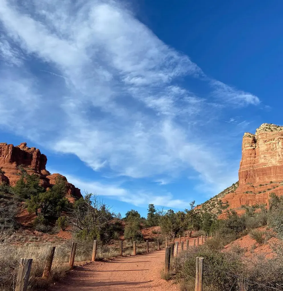
The route progressively rises along a ridgeline that is prominently exposed, giving hikers amazing views of the surroundings. Red rock formations are striking natural features that pause the ride and offer great photo opportunities. Although the trail is well-marked in the first part of it, it gets fuzzier after that.
For this reason, downloading an offline map is highly advised for hikers to make navigating easier. This kind of planning will improve the hiking experience in general and make the trip safer and more pleasurable.
- Difficulty Level: Moderate
- Distance: 1.3 km
10. Fay Canyon Trail
One of Sedona's best hiking trails, the Fay Canyon Trail, is reachable from the parking lot and trailhead located on Boynton Pass Road. A panorama of magnificent rock formations, distinguished by their vivid red colors and towering canyon walls, may be seen from this lovely walk.
Hikers can find plenty of shade under the trail's canopy, and a cold canyon floor offers a welcome break from the heat. It's a very enjoyable ride overall, despite some difficult stretches crossing ancient, dry creek beds.
Hikers can enjoy beautiful views of the surrounding cliffs at the Fay Canyon Arch, a natural wonder located halfway down the walk. This is one of the trail's highlights. For anyone visiting the area who wants to fully experience the natural splendor of the area, this walk is a must.
- Difficulty Level: Moderate
- Distance: 3.9 km
11. Courthouse Butte and Bell Rock Loop
The loop gives a once-in-a-lifetime chance to see the spectacular solitude of the Sedona desert. Visitors are shown a mesmerizing panorama of the area's unique red-rock formations as the ride progresses.
The terrain is dominated by soaring cliffs, enormous rock formations, and expansive views, all rendered in a rich palette of scarlet, red, and gold tones. Famous locations like Bell Rock and Courthouse Butte make breathtaking backgrounds, creating a lasting effect on everyone who sees this amazing natural show.
- Difficulty Level: Moderate
- Distance: 5.8 km
12. Sedona Airport Loop Trail
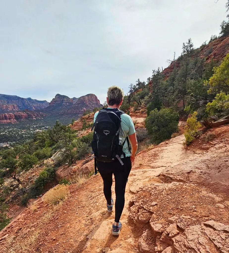
The higher slope of Airport Mesa, also known as Table Top Mountain, is encircled by the Airport Loop Trail. This trail, with its rough terrain and scattered rocky sections, offers a demanding but rewarding experience. Hikers are encouraged to prepare appropriately with plenty of water and sun protection due to the minimal shade throughout the route.
It is considered one of the best places to hike in Sedona as the walk is well known for its spectacular views of red rock formations; the best part is the group of fascinating basalt boulders close to the top of the mesa.
- Difficulty Level: Moderate
- Distance: 5.3 km
13. Sugarloaf Loop Summit and Tea Cup Loop
The hike gives an amazing view of the major mountain ranges in Sedona. Trekkers who venture down the rough trail are rewarded with stunning views of the area's well-known red rock formations. Starting at the Tea Cup Trail, the path joins the Sugar Loaf Loop perfectly and ends at the peak.
Despite its short length, the trail offers a difficult climb with multiple steep sections that lead to the summit. It is advisable to arrive early to get a parking space, as parking is limited.
- Difficulty Level: Moderate
- Distance: 3.2 km
14. Bell Rock Pathway to Bell Rock
The Bell Rock Vista Trail provides a difficult but worthwhile climb to the top of Bell Rock, with breathtaking views of the Red Rock Valley as a reward. Because of its popularity, hikers should expect limited parking at the trailhead and note that this spot is not served by the Sedona Shuttle.
Due to the trail's natural topography, which consists of pebbles, sand, and dirt, people with mobility issues may need to use adaptive equipment or all-terrain gear. The trail is mostly moderate in grade, although some steeper parts need to be handled carefully or with help. At the trailhead is a vault toilet that is wheelchair accessible.
Also, Wheelchair Traveling points to a parking lot south of Bell Rock Butte as an alternate entry point to the Bell Rock Pathway. There is a nearby wheelchair-accessible restroom and limited ADA parking available at this location.
- Difficulty Level: Moderate
- Distance: 4.5 km
15. Bear Mountain Trail

At the summit of Bear Mountain, one is treated to expansive, spectacular views. Hikers should be ready for bad weather, though, as the summit is prone to wind and chilly temperatures. Wearing a windbreaker is therefore advised for increased warmth and protection.
The trail itself is difficult, with multiple false summits that could lead climbers astray. It is crucial to stick to the white diamond trail markers to stay on the correct route. There are also opportunities along the way to take in the untamed splendor of northeastern Fay Canyon. It is highly advised to wear sturdy footwear with excellent traction due to the rough terrain and severe drops on the trek.
- Difficulty Level: Hard
- Distance: 7.4 km
16. Fay Canyon Arch Trail
The Fay Canyon path is a great option for individuals looking for short hikes in Sedona easy adventure. This path, with its gentle elevation changes, draws travelers into a world of breathtaking natural beauty. The trail winds through the canyon with a spectacular backdrop of towering red sandstone walls.
The trek ends in an impressive naturally occurring stone arch that bears witness to the region's geological processes. Though small in size, this remote canyon offers wide views of the surrounding cliffs and a variety of desert plants.
- Difficulty Level: Moderate
- Distance: 2.4 km
17. Doe Mountain Trail
Hikers can reach the top of the mesa with this trail in a comparatively short amount of time while still feeling somewhat rejuvenated. Ascending to the summit offers visitors breath-taking, all-encompassing views of the surrounding red rock formations and the vast panoramas that extend in all directions.
Although the trip is not very long overall, some steep sections of the trail need some effort. This difficult but worthwhile voyage provides a unique chance to experience the natural splendor of the Verde Valley and take in the astonishing landscape of the Coconino National Forest.
- Difficulty Level: Moderate
- Distance: 2.4 km
18. Teacup Trail to Coffeepot Rock
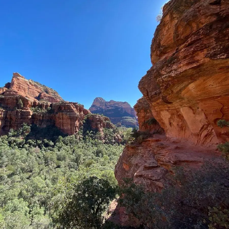
Certainly beautiful, the trek to Coffee Pot Rock provides hikers with a tranquil getaway into the natural world. Its route meanders across an area distinguished by expansive views that entice introspection. Hikers encounter terrain that can be uneven and difficult in spots as they go, demanding careful footing.
The trek ends with the breathtaking sight of Coffee Pot Rock, its unique shape soaring over the horizon. This geological wonder is a major attraction for many travelers and a monument to the area's natural splendor. For those looking for a relaxing afternoon visit where they can fully appreciate the beauty of the surroundings, the trail is especially ideal.
- Difficulty Level: Easy
- Distance: 4.2 km
19. Hangover Trail
This route offers a different, precise route to the popular Hangover Trail Loop. Hikers start at the Huckaby Trailhead and go over a rocky desert terrain on the Munds Wagon Trail. This first section ends at the intersection with the actual Hangover Trail.
The next part of the trip is a descent across several sharp hills that meet at a saddle between Pointed Dome and Queen Victoria, two of the area's most notable sights. From this viewpoint, hikers can enjoy some of the most spectacular views before returning the same way.
- Difficulty Level: Moderate
- Distance: 9.8 km
20. Oak Creek Trail
Red Rock Crossing, also known as Buddha Beach, is a reachable location inside Crescent Moon Ranch. Views of Cathedral Rock and the rumored Red Rock Crossing Vortex hikes in Sedona AZ are available to visitors from this elevated location. The park is very accessible, with paved paths encircling Crescent Moon Ranch.
However, the rest of the trail is over red rock, so people in wheelchairs, with mobility issues, or pushing strollers might need to bring special equipment or all-terrain footwear. Although the terrain varies, the trail is generally wide and has a gentle incline.
There is plenty of parking, including spaces reserved for those with disabilities, and the park has a large picnic area with tables and restrooms accessible to wheelchairs in when hiking Sedona Oak Creek Canyon.
- Difficulty Level: Easy
- Distance: 2.1 km


