Even though a large portion of Texas is the rugged desert that you would imagine, you might be surprised by the variety of the trails. The Lone Star State boasts several hidden jewels, from verdant swimming holes to meadows filled with wildflowers and stunning views from the summit.
This list of the top trails and hikes in Texas has something for everyone, whether you're searching for a quick getaway near town or an all-day trek in the backcountry.
1. Guadalupe Peak Trail
- Distance: 13.0 km
- Elevation Gain: 899 m
- Route Type: Out & back
- Difficulty Level: Hard
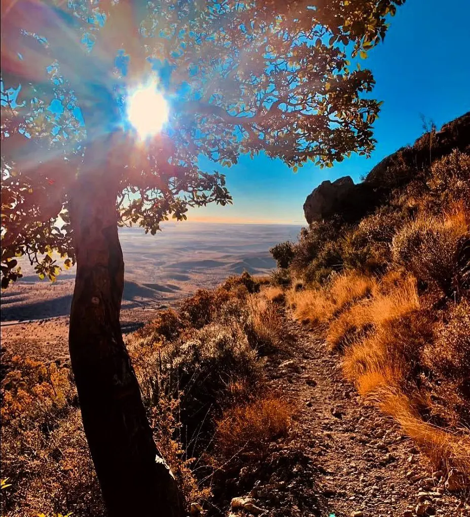
Though somewhat demanding on the hike, this is a wonderful path up Guadalupe Peak. The hiking around trip will take six to eight hours to finish. The hike offers breathtaking vistas from Texas's highest point, 8,749 feet. Additionally, it introduces hikers to a number of the park's ecosystems, such as the high desert and the forests at high altitudes.
The entrance to Guadalupe Mountains National Park is not free, but you can also buy annual passes. A wide variety of plants and animals can be found at Guadalupe Mountains National Park. The park offers a plethora of additional hiking routes and leisure opportunities.
2. Lost Mine Trail
- Distance: 7.7 km
- Elevation Gain: 345 m
- Route Type: Out & back
- Difficulty Level: Moderate
The Lost Mine Trail is rated as fairly challenging and takes an average of 2 hours and 30 minutes to complete. An excellent introduction to the Chisos Mountains' vegetation and animals may be found on the Lost Mine route.
There's a saddle about a mile into the trek that provides fantastic views of Juniper Canyon, Casa Grande, and the larger Chisos basin. From the parking area, the rest of the trail climbs steeply through forests of pine, oak, and juniper.
The trail levels out abruptly at a crest with breathtaking views of Mexico's Sierra del Carmen and Pine Canyon. This is undoubtedly one of the nicest day hikes in Big Bend, at slightly less than 5 miles total.
3. The Window Trail
- Distance: 8.9 km
- Elevation Gain: 293 m
- Route Type: Out & back
- Difficulty Level: Moderate
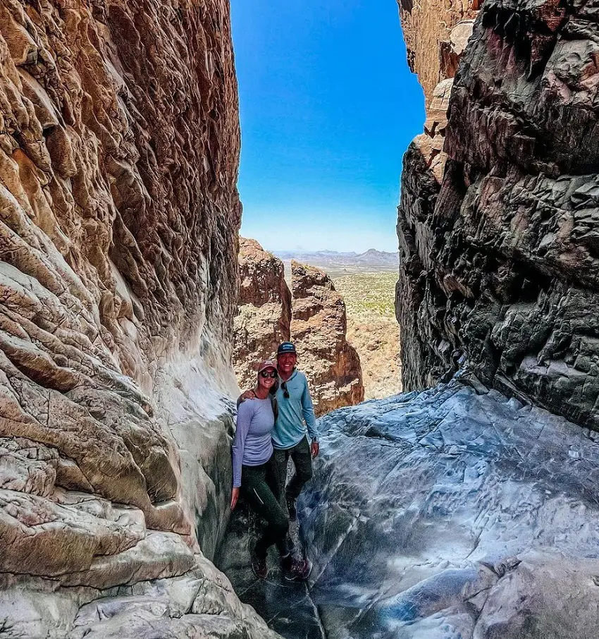
Starting close to the Chisos Basin Lodge, the Window Trail descends 800 feet over approximately two miles over undulating terrain and steep rock walls to a slender pour-off that provides a view of the surrounding Chihuahuan Desert.
Although the trail is typically dry, when flash floods, the pour-off region is quite dangerous. Trail difficulty is moderate and it takes about two hours and thirty-five minutes on average. Sadly, dogs are not permitted on this hiking trail.
4. The Lighthouse Trail
- Distance: 9.5 km
- Elevation Gain: 162 m
- Route Type: Out & back
- Difficulty Level: Moderate
One of the most well-known rock formations, it can get relatively crowded during the peak travel season. The trail begins at a sizable parking area and proceeds along a broad path through patches of low shrubs in a sandy setting.
The valley is surrounded by stunning, multicolored rocks that lead to the creation of the lighthouse. Given its modest difficulty, the Lighthouse Trail takes a little over two hours to complete. Dogs on leashes are also welcome.
5. Crockett Gardens Falls
- Distance: 6.0 km
- Elevation Gain: 90 m
- Route Type: Out & back
- Difficulty Level: Moderate
The Crockett Gardens Falls takes an average of 1 hour 22 minutes to complete and is generally regarded as a moderately difficult route. Even though the trail passes through steep and hilly terrain and has few markers. It's among Texas' most breathtaking waterfall treks.
All things considered, this is a lovely and tranquil stroll through the forest that culminates in the breathtaking Crockett Gardens Falls. Dogs are permitted on this trail as well, but they must always be leashed.
6. Santa Elena Canyon Trail

- Distance: 2.6 km
- Elevation Gain: 67 m
- Route Type: Out & back
- Difficulty Level: Easy
One of the easiest trails on this list, the Santa Elena Canyon Trail is 1.6 miles and takes around 40 minutes to complete. This trail starts at a paved parking lot near the end of Ross Maxwell Scenic Drive. It's a small route, but one of the park's most picturesque sections
The trail crosses Terlingua Creek, has a few small switchback climbs, and then gradually drops down the Rio Grande's banks. Surrounded by dense riparian flora, hikers encounter 1,500-foot tall vertical limestone cliffs. The trail ends where the river meets the canyon walls. Eat lunch and take in the scenery.
7. Devils Hall Trail
- Distance: 6.1 km
- Elevation Gain: 183 m
- Route Type: Out & back
- Difficulty Level: Moderate
The route through the wash requires rock scrambling and is unsafe when wet or there is water present. The hike to Devil's Hall is fairly difficult. Rocks and loose gravel make up the wash surface, which could be unstable. Scrambling on stones on this climb can be highly complex, requiring experienced abilities and the right equipment.
The entire journey is lined with scenic high desert views to enjoy, and in the spring, the surrounding flora produces an abundance of gorgeous blooms. There is often wildlife to be seen along the way.
8. Ann and Roy Butler Hike-and-Bike Trail
- Distance: 15.9 km
- Elevation Gain: 75 m
- Route Type: Loop
- Difficulty Level: Easy
Both locals and tourists adore the Ann and Roy Butler Hike-and-Bike Trail, which bears the names of a former Austin mayor and his spouse. It connects Austin's metropolitan core and provides a green urban retreat in addition to being a commuter route. The Trail Conservancy maintains the route, which is around Lady Bird Lake.
Although there are other locations where hikers might start the trail, the map indicates that this path starts at Town Lake Park's Butler Shores parking lot. Hence, this trail is regarded as easy; it takes three hours and four minutes on average to finish.
9. Emory Peak Trail
- Distance: 15.8 km
- Elevation Gain: 760 m
- Route Type: Out & back
- Difficulty Level: Hard
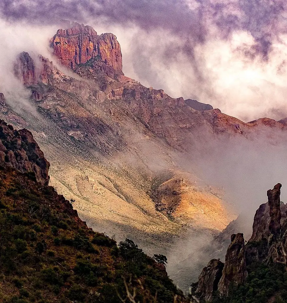
This hike to the highest peak in Big Bend National Park (7,832') is a strenuous and complex round-trip. You must scramble up a sheer rock wall for the final 25 feet, but the payoff is the most breathtaking panoramic view. Proceed 3.5 miles on the Pinnacles Trail from the Basin Trailhead.
The mile-long trail leading to the peak splits off here and climbs higher. This trail is highly recommended for its breathtaking views and seclusion. Hence, it is not a dog-friendly trail.
10. River Place Canyon Trail
- Distance: 8.7 km
- Elevation Gain: 249 m
- Route Type: Out & back
- Difficulty Level: Moderate
A fantastic location to hike which is close to the city is the River Place Canyon Trail. Due to the elevation climb and numerous steps, expect an increased heart rate. There are tight and uneven sections of the trail, so be cautious where you go and give other hikers space.
In certain spots, there are breathtaking views over the hilltop. There is a cost to access the route on weekends. Hikers must pay a daily charge, which may only be made with a credit card. Kids under 12 go free when accompanied by an adult.
11. Cedar Ridge Outer Loop
- Distance: 8.9 km
- Elevation Gain: 210 m
- Route Type: Loop
- Difficulty Level: Moderate
The moderate two to three-hour experience can be taken on the Cedar Ridge Outer Loop Trail. With this trail, you can visit nearly all of Cedar Ridge's treasures, including the Praire, Bluebonnet, Escarpment, Fossil Valley, Possumhaw, and Cedar Brake trails.
Hiking on this walk-at-your-own-risk trail requires you to use caution and responsibility. Remember to pack lots of water and comfortable shoes. The loop's finale circles the wildflower trail, offers fantastic views along the route to an overlook, and experiences a few small elevation variations.
12. Enchanted Rock Summit Trail
- Distance: 2.1 km
- Elevation Gain: 129 m
- Route Type: Out & back
- Difficulty Level: Moderate
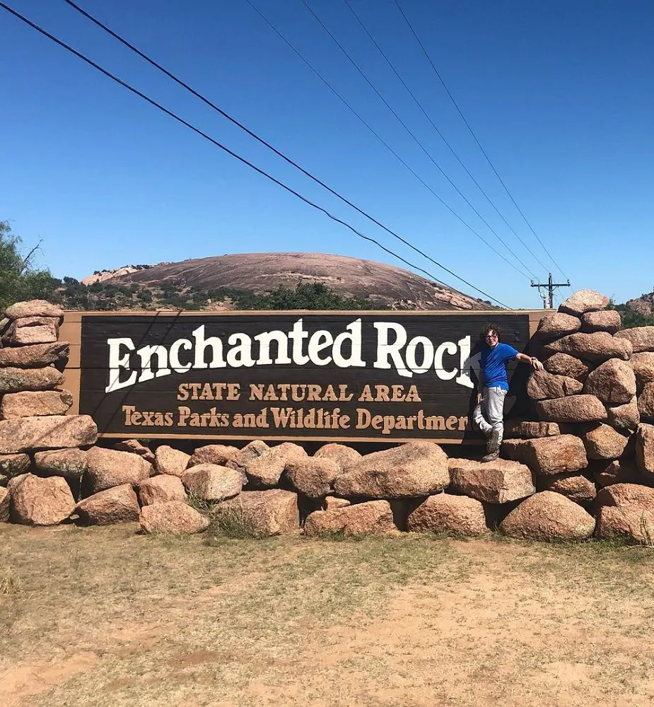
The 2.1-kilometer Enchanted Rock Summit Trail is an out-and-back path close to Willow City, Texas. It takes an average of 50 minutes to complete and is generally regarded as a moderately demanding course. From its 1,823-foot summit, it provides stunning panoramic vistas of the Texas Hill Country.
The park can get extremely busy on weekends, holidays, and during school breaks. When it fills up, it might even close. Using the state parks reservation system, you can buy "Save the Day" passes up to 30 days in advance to avoid disappointment and passes could only be accessible online during peak periods.
13. Homestead Trail
- Distance: 5.5 km
- Elevation Gain: 49 m
- Route Type: Loop
- Difficulty Level: Easy
One of the easier paths is the Homestead Trail, which takes an average of 1 hour and 10 minutes to finish. This fantastic walk is located at McKinney Falls State Park, just behind the Lower Falls.
The actual route is a broad, well-kept gravel walk with lots of branches. If the water levels are moderate or high, be ready to jump from rock to rock over the falls, or pack water shoes for the shallow section uphill.
14. Eagle Mountain Lake Park Trail
- Distance: 12.1 km
- Elevation Gain: 176 m
- Route Type: Loop
- Difficulty Level: Moderate
The eastern shore of Eagle Lake can be beautifully viewed from this path. For those looking to increase their distance, this trail is excellent for beginners. For those wishing to plan their own itinerary, there is a map available at each junction on the well-maintained track.
There is an easier detour for each difficult section. Along the route, there are numerous chances to see local flowers and fauna. The trail takes an average of 2 hours 44 minutes to complete, making it a moderately difficult one.
15. Barton Creek Greenbelt Trail
- Distance: 22.9 km
- Elevation Gain: 219 m
- Route Type: Out & back
- Difficulty Level: Moderate
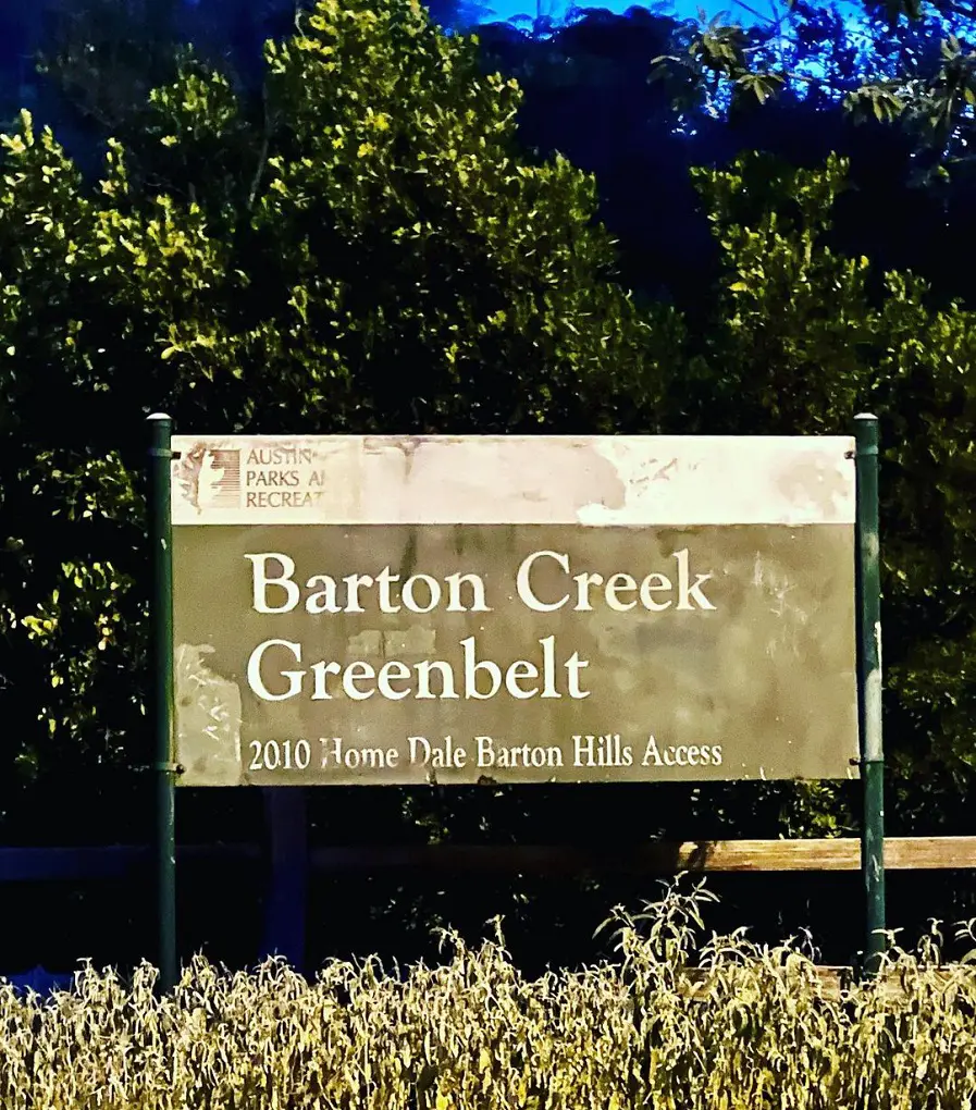
Along the creek runs a stunning and vast network of trails known as the Barton Creek Greenbelt. The trail itself has multiple uses and at various points can be rocky and rugged. Barton Creek dries out seasonally, thus occasionally it may be partly or even entirely dry.
Along the walk, wildlife is frequently encountered in numerous locations. The 22.9 km out-and-back track is located close to Austin, Texas. It takes 4 hours 47 minutes on average to finish and is generally regarded as a moderately challenging trail.
16. South Rim Trail Loop
- Distance: 20.4 km
- Elevation Gain: 738 m
- Route Type: Loop
- Difficulty Level: Hard
One of the park's hardest hikes is to the South Rim. To get to the South Rim, you can either take the Pinnacles Trail or the Laguna Meadows Trail. Although Laguna Meadows is gentler, there are switchbacks on both. From the rim, views of the mountains in Northern Mexico are available.
It's generally regarded as a difficult route, taking an average of 6 hours and 10 minutes to finish.
17. Onion Creek Trail
- Distance: 6.0 km
- Elevation Gain: 64 m
- Route Type: Loop
- Difficulty Level: Moderate
This long paved loop winds through the shaded banks of Onion Creek, sharing the path with cyclists, runners, and hikers. At the north end of the walk, in the paved parking lot off McKinney Falls Parkway, there is at least one designated accessible place.
It has striped access aisles and is van-accessible. The paved asphalt trail surface has some cracks and lumps in it. Usually, it is at least four feet broad. Dogs on a leash are allowed on the Onion Creek Trail.
18. El Paso Tin Mines Trail
- Distance: 10.6 km
- Elevation Gain: 312 m
- Route Type: Out & back
- Difficulty Level: Moderate
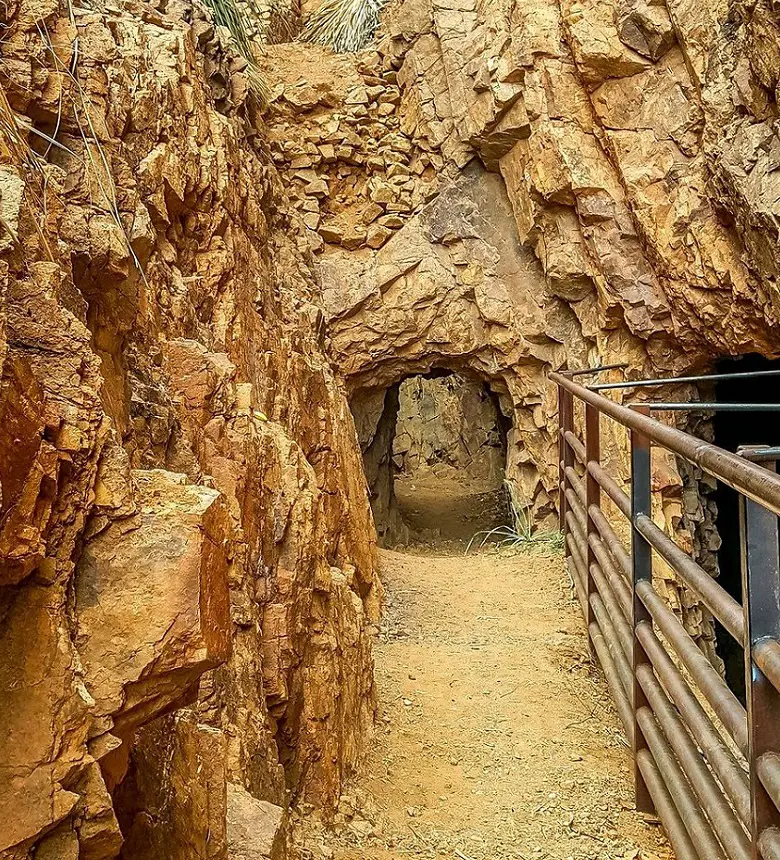
Located within the remarkably underrated Franklin Mountains State Park, the 6.6-mile El Paso Tin Mines Trail boasts an elevation rise of slightly over 1,000 feet, making it a somewhat difficult climb.
It's an experience that should be on everyone's bucket list because of the amazing surroundings and abandoned tin mines that are located close to the trail's end. For practically the whole climb, you'll be treated to expansive views of the city and the mountains that the park is named after. This trail will take about three hours to finish on average.
19. Three Falls Hike
- Distance: 11.7 km
- Elevation Gain: 84 m
- Route Type: Out & back
- Difficulty Level: Moderate
A well-liked 11.7-kilometer out-and-back hike called the Three Falls Hike is situated close to Austin, Texas. Hikers, mountain bikers, and runners will find this trail to be enjoyable because of its moderate challenge and natural splendor.
Although the falls themselves are a seasonal feature and may dry up at times, the surrounding area is always lovely. As long as they are leashed, dogs are allowed on the trail. The trail can get congested during the busiest times of the year, especially when the falls are running. But there's plenty of shade to protect you from the summer heat.
20. Arbor Hills Tower Trail
- Distance: 4.2 km
- Elevation Gain: 41 m
- Route Type: Loop
- Difficulty Level: Easy
This is a great loop with stunning scenery that links to other trails over a variety of terrains and surfaces. In the spring and summer, there is an abundance of wildflowers to appreciate. With its low elevation increase and relatively easy walk, this is an excellent place for kids to explore.
Texas has a few muddy spots, particularly after a little rain, but other than that, the path is in good condition, with lovely views and a moderate difficulty level. To avoid crowds and stay hydrated, it is advised to start early. It can get rather crowded, especially during chilly months.


